How AVAG brings FARO data to life
Updated:
Got FARO hardware on site? Here’s how FARO data flows into AVAG.

The ability to capture accurate 3D data is only half the challenge. The other half is doing something useful with it quickly, collaboratively, and without specialist software standing in the way.
AVAG supports the full range of FARO scanning hardware, alongside drones, mobile mapping systems, and handheld LiDARs from other manufacturers. Every dataset, regardless of how it was captured, flows into the same platform. Your team accesses it from a browser, so there’s no need to merge anything or switch between platforms.
This article explains how FARO devices work, what data they produce, and how AVAG handles every step from output file to finished project.
Watch the video: We took the FARO BLINK to a 17th-century chateau, and this is what came out.
What FARO devices do and what they produce
FARO makes a range of reality capture hardware: tripod-mounted terrestrial scanners, mobile indoor scanners, and handheld devices. Each one captures the physical environment as a point cloud, a dense collection of millions of individual 3D coordinates measured by laser.
Here’s how they work in practice.
How laser scanning works
A laser scanner emits a beam of infrared laser light onto a rotating mirror that sweeps continuously across the surrounding environment. Each time the beam strikes a surface, the device measures the precise distance using time-of-flight or phase-based ranging. Repeat that process millions of times per second, and the result is a detailed three-dimensional map of everything the scanner can see from that position.
A single scan captures only what’s visible from one vantage point. For a complete picture of a space, teams typically place the scanner at multiple positions and register the scans together, aligning overlapping data into a single coherent model.
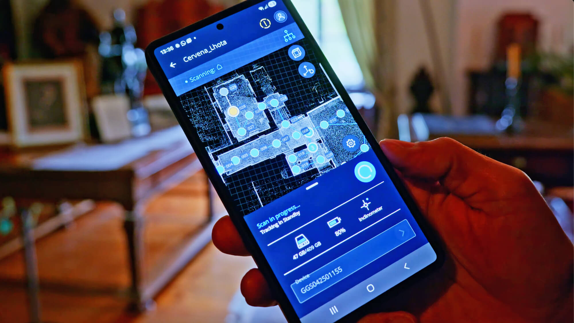
Using the FARO Stream app to manage 3D laser scans directly on-site
Beyond geometry, modern FARO scanners also capture color. Integrated cameras photograph the environment during or after the scan, and the imagery is mapped onto the point cloud to produce a richly detailed, color-accurate 3D record of the site.
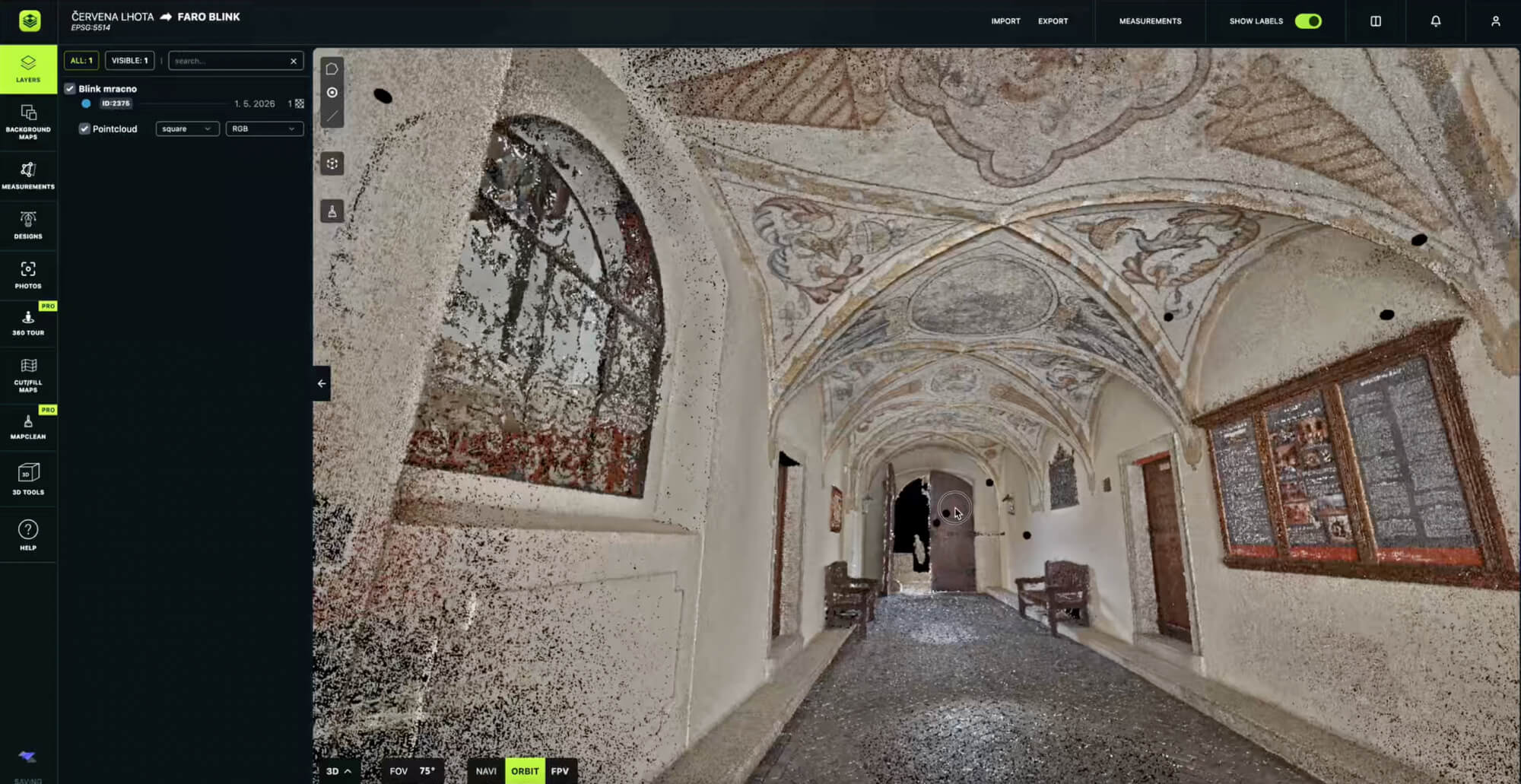
A point cloud created with FARO Blink and uploaded to AVAG
FARO devices supported in AVAG
FARO Focus: Terrestrial laser scanner
The Focus is FARO’s flagship tripod-mounted scanner, designed for high-precision static capture in demanding environments. Set it up, press scan, and within minutes it produces a full 360° point cloud of the surrounding area at ranges of up to 400 metres.
The Focus is well established across surveying, construction, infrastructure, and public safety. It’s the tool of choice when accuracy is the priority and the environment allows for a controlled, stationary setup, so think building interiors, bridge structures, large industrial assets, or heritage sites.
FARO Orbis / FARO Orbis Premium: Mobile indoor mapping system
Where the Focus requires the scanner to stay still, the Orbis is designed to keep moving. Operators carry or push it through a space while it continuously captures the environment using SLAM (Simultaneous Localization and Mapping), a technique that builds a 3D map in real time by tracking the scanner’s own position relative to the geometry it’s measuring.
The result is dramatically faster coverage of large or complex interiors: warehouses, underground mines, or dense multi-room facilities, i. e., environments where setting up dozens of static scan positions would be impractical. The Orbis Premium adds a high-resolution camera for colorized point clouds and 360° panoramic imagery, along with FARO’s Flash Technology, which pauses the mobile capture to take a high-accuracy static scan at any point, combining the speed of mobile scanning with the precision of traditional methods.
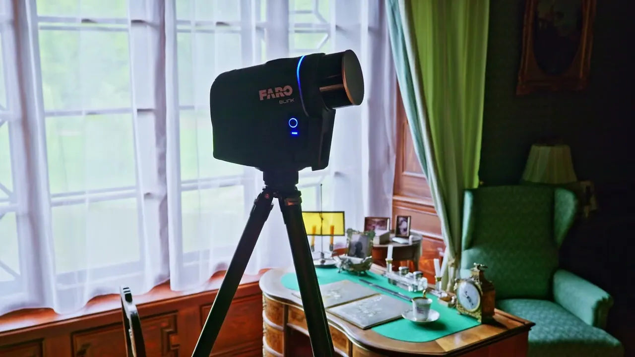
FARO BLINK: A one-button laser scanner
The BLINK is FARO’s most accessible scanning device: a one-button scanner designed so that anyone can use it on site, regardless of prior experience. It combines a traditional 360° static scan (30 seconds per position) with an integrated SLAM system that captures data as the user moves between positions. The result is an automatically pre-registered point cloud, with 360° HDR imagery, produced with minimal manual input.
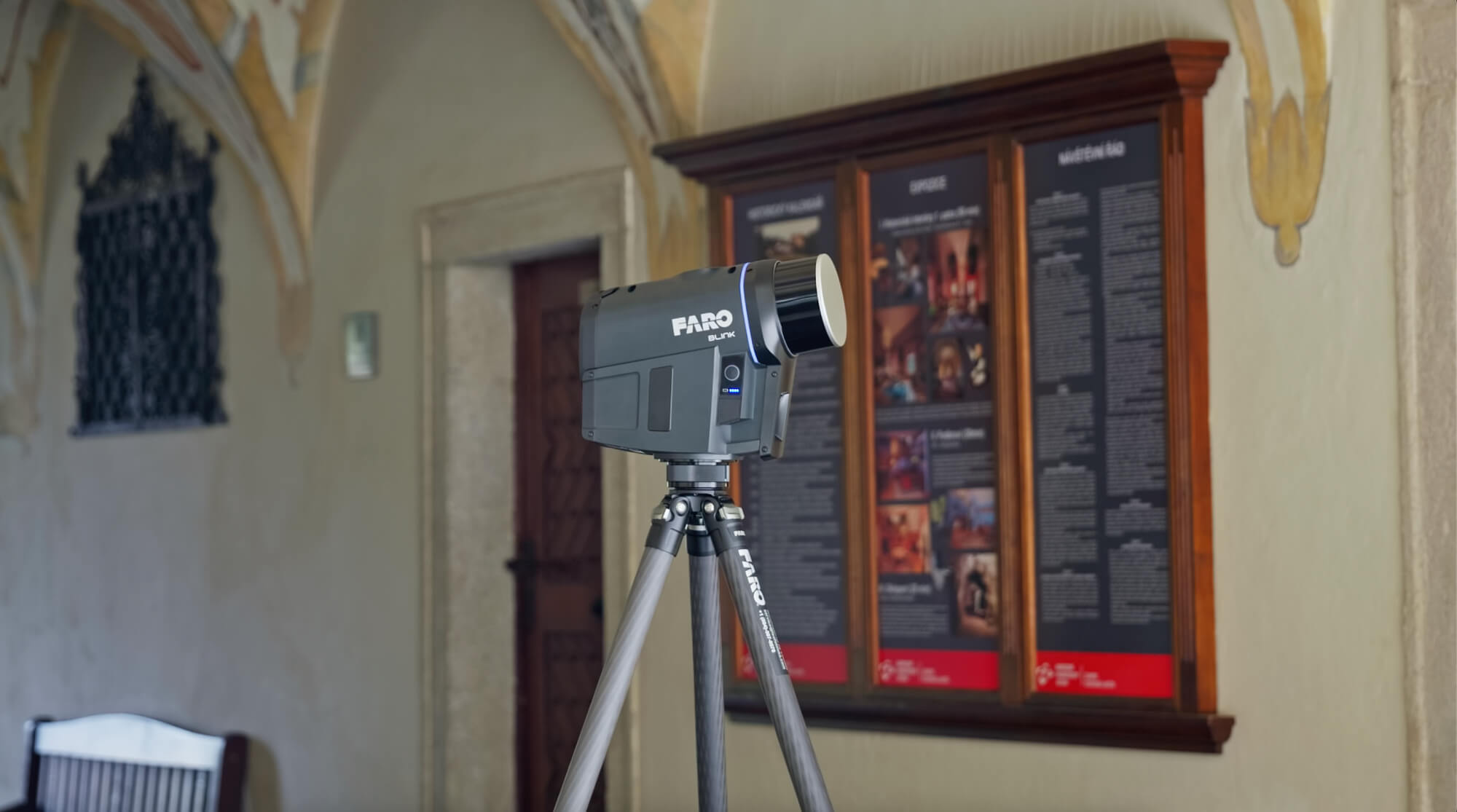
FARO Blink scanning the exterior of a chateau
What AVAG does with FARO data
AVAG ingests the standard outputs of FARO scanning workflows, so you don’t have to convert any data or manually merge anything.
Point clouds (.las), the primary 3D datasets from any FARO device, load straight into AVAG and can be layered with any other spatial data in your project. 360° panoramas (.jpg) captured alongside scans import as navigable panoramic layers. Trajectories from mobile scanners provide the movement path of the device through the space, which can be useful for understanding data provenance and aligning datasets.
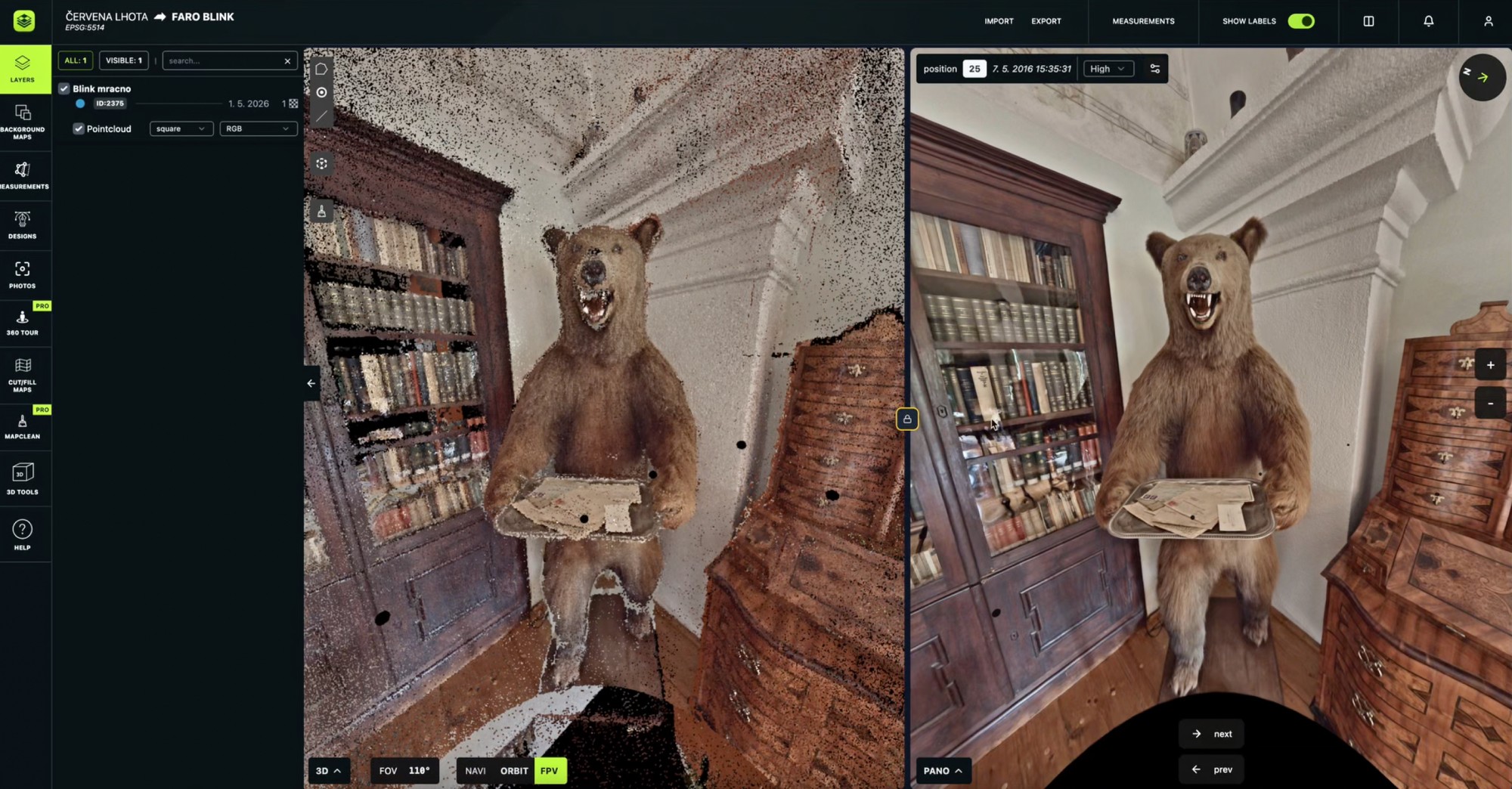
Working with FARO data inside AVAG
Critically, AVAG can treat all of this as a single object with many layers. A FARO Focus scan of a building interior, a drone flight over the surrounding site, and a mobile Orbis capture of an underground level all exist together in the same workspace. Your team navigates between them from a browser, without needing specialist GIS software or any other desktop tool.
FARO in context: The broader AVAG ecosystem
FARO devices are part of a wider set of hardware that AVAG supports. The platform is built around the reality that modern site documentation rarely involves a single device.
Drones: RGB camera drones feed directly into AVAG for photogrammetric processing, volumetric analysis, and audit-ready reporting, no specific model required, just fly your existing fleet. LiDAR-equipped drones add dense aerial point clouds for corridor mapping, vegetation penetration, and infrastructure inspection from above.
Terrestrial & handheld scanners: FARO Focus, FARO Orbis, and FARO BLINK are covered in detail above. Beyond FARO, AVAG also supports GeoSLAM for confined spaces and complex interiors, and CHC RS10 for survey-grade handheld point clouds that combine with drone data for complete site documentation.
Mobile mapping & 360° imaging: Mosaic X is a multi-camera 360° mapping system whose point clouds and panoramic imagery can align with other geospatial data in the same AVAG object. iStar Pulsar imports as a panoramic layer alongside scan and drone data. FLIR Ladybug 5+ imagery can also combine with other data from the same site.
What this means in practice
If your site documentation currently involves FARO hardware, the workflow is straightforward:
Capture on site using your FARO device
Process and register in FARO SCENE (or Connect, iQscene, Stream, etc., depending on your device)
Export point clouds, panoramas, and trajectories
Load directly into AVAG
From that point, your data lives in a shared project environment, accessible to the whole team, combinable with aerial and other geospatial data, and ready for measurement, annotation, reporting, and collaboration.
FARO captures the detail. AVAG is where that detail becomes a working asset. Want to see it yourself? Start your free 14-day trial.
Which FARO scanner is best for construction sites?
Is AVAG a replacement for FARO Sphere XG?
Can AVAG combine FARO scan data with drone data on the same project?
See what your geospatial data can really do
Join more than 1,000 satisfied users. Just upload your files and see results.
No credit card required

About the author

Marek Ruzek
CTO at AVAG Pro
Marek Ruzek is the CEO and co-owner of AirView s.r.o. and the CTO behind AVAG, a cloud platform built for construction and surveying professionals working with drone data, photogrammetry, and 3D geospatial workflows. With nearly a decade leading AirView, he has been at the forefront of bringing drone-data technology to major infrastructure projects across the Czech Republic, including the D3 highway, the PPP D4 project, and large-scale earthworks monitoring.
Subscribe and do not miss latest posts
Blog
Explore more articles

The complete guide to choosing photogrammetry software (2026)
If you’re currrently choosing your next photogrammetry platform, this guide is for you.
Read more

Ground Sample Distance: What GSD really means for your site projects
Flying a 50-megapixel drone but still getting blurry maps? Here’s what you’re missing.
Read more