Solutions
One platform from upload to client delivery
Stop stitching together five tools to finish one project.
Process data, generate reports, and share results with clients, all in AVAG.
Why growing a drone survey business gets harder, not easier
At two pilots, it’s manageable. At ten, the workflow breaks.
Tool sprawl
Processing happens in one app, reporting in another, sharing via email or Dropbox, client feedback over WhatsApp.
No client portal
Clients have no single place to view their data, so every delivery triggers a round of support emails.
Inconsistent outputs
Different team members produce different report formats.
Margin erosion
The more projects you take on, the more post-processing admin you absorb, and it never makes it onto the invoice.
Delivery delays
Data is ready but the report isn’t, or the report is ready but the client can't open the files.
You’re selling aerial data. You shouldn’t be spending half your time on file management.
From raw flight data to client-ready report without leaving AVAG
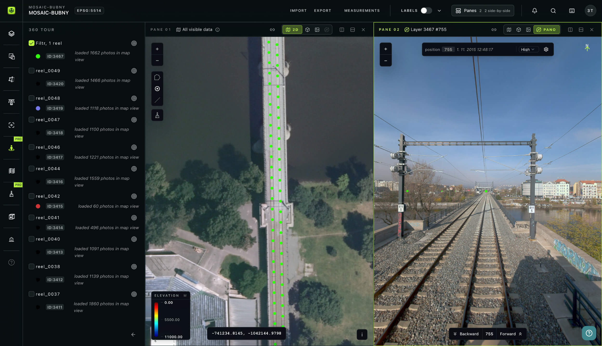
Upload drone data, process it into 2D and 3D models, annotate findings, calculate volumes, generate elevation profiles, and export a PDF report, all inside one platform. No exports to external software. No reformatting for different clients. No reassembling outputs at the end.
What used to take a half-day of post-processing admin takes a fraction of the time.
www.avagpro.com
www.avagpro.com
Give clients access to the drone data and insights
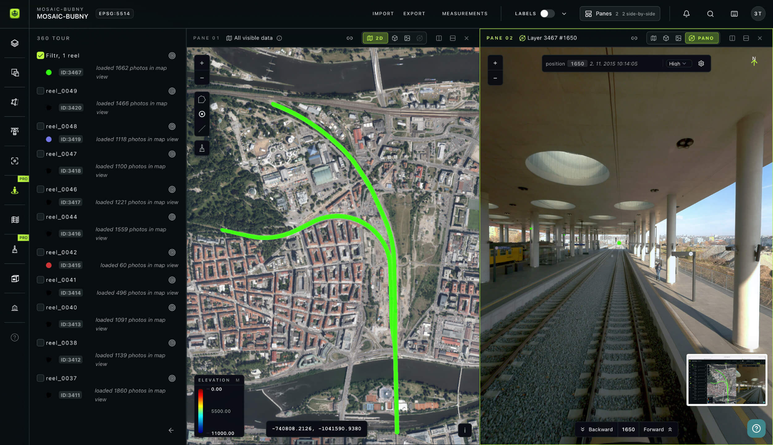
Share processed data directly with clients through AVAG: they get a clean, navigable view of their site without needing any software of their own. No per-seat fees means you can onboard every stakeholder on a project without watching the cost climb.
Sell monitoring, not just surveys
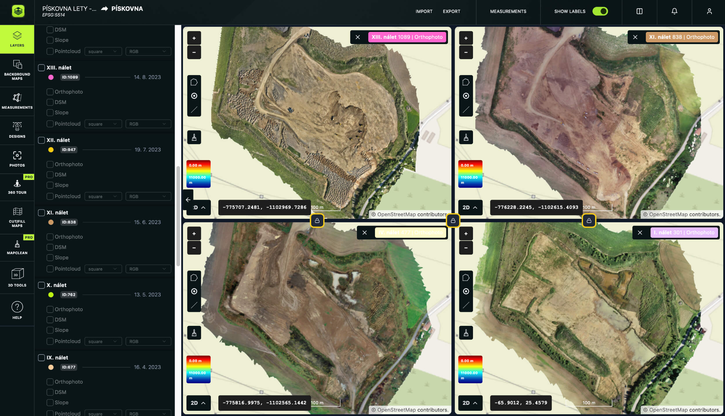
The difference between a one-off job and a recurring contract is being able to show change over time. Multi-window comparison lets you present several time periods simultaneously, turning a single drone service into a long-term monitoring relationship.
Show clients what’s changed, what’s on track, and what needs attention. That’s a conversation that leads to contract renewals, not just invoices.
www.avagpro.com
Drone service providers
How AVAG helps drone service providers
Process data, generate reports, and share results with clients, all in one platform. Spend less time on post-processing admin and more time flying. AVAG turns processing drone data into a scalable, repeatable workflow.
Read how QTS Group shares railway construction data at scale: with AVAG, their 4-person drone team now supports 99 active users across 800 staff, using instant 2D/3D access to more than 117 datasets nationwide.
from different teams accessing data and collaborating seamlessly

Your new workflow
Monday 9am
Monday 1pm
Monday 2pm
Monday 3pm
Monday 4pm
Result
Project delivered, client notified, job closed.
Cut post-processing time by 60–70%. Deliver to more clients without adding headcount.
Benefits
Why drone survey companies choose AVAG
One platform
Processing, reporting, and client delivery without switching tools
Consistent outputs
Every team member produces the same quality report, every time
Unlimited client users
Share with entire project teams at no extra cost
Defensible documentation
Accurate reports that satisfy everyone
Multi-window comparison
Turn one-off surveys into recurring monitoring contracts
DJI Dock ready
The only EU platform supporting fully automated survey and processing
Trusted by market leaders
Start your free trial
14 days • 200 GB storage • No credit card required
Upload your drone data and see results within hours.

Solutions
Frequently asked questions
How does AVAG help drone survey companies scale their operations?
AVAG consolidates the processing, reporting, and client delivery steps that typically require separate tools into a single platform. By eliminating the need to move data between a processing application, a reporting tool, and a file-sharing service, drone survey companies reduce post-processing time by 60–70% per project, allowing the same team to handle significantly more client volume without adding headcount or infrastructure.
Can drone service companies use AVAG as part of their client delivery workflow?
AVAG is designed to sit at the centre of a drone survey company's delivery workflow, handling processing, annotation, volume calculation, report generation, and client sharing in a single platform. Rather than emailing files or setting up separate sharing tools for each client, drone service companies invite clients directly into the project with controlled access rights. Clients see a clean, navigable view of their data in a browser. No software installation required.
What data formats does AVAG accept from drone flights?
AVAG works with data from most drone platforms and common photogrammetry workflows, so there is no need to change your existing capture setup. If you already process data externally, AVAG imports outputs directly from Pix4D, Agisoft, 3DSurvey, and DroneDeploy, accepting TIFF orthophotos and DSMs, LAS and LAZ point clouds, and mesh data as a ZIP package containing JPG, OBJ, and MTL files. For raw imagery, AVAG accepts standard RGB JPG files, high-resolution grid photos from Mavic 3E, 360° panoramic images, and imagery captured with or without GPS, all processed directly within the platform. For map visualization and overlay, AVAG supports CAD drawings, WMS services, 3D models, DXF, TXT, CSV, Shapefile, and PDF formats. Any coordinate system is supported, with no reformatting required when switching between client projects or data sources.
How long does data processing take in AVAG?
It depends on dataset size and the accuracy level required. For fast turnaround projects, automated processing of up to 250 photos without GCPs completes in 35 minutes from upload. For larger or more complex datasets requiring survey-grade accuracy, expert processing of up to 5,000 photos with GCPs completes in around 9 hours, still within the same working day. Drone service companies can choose between the two processing tiers depending on what each project requires.
Does AVAG support both basic and survey-grade photogrammetry processing?
Yes. AVAG offers Automated processing without ground control points (GCPs) for fast turnaround projects where survey-grade accuracy is not required, and Expert processing with GCPs for projects demanding centimeter-level accuracy.
Do we need expensive computers?
No. The cloud-based platform runs in any browser and works on basic laptops, tablets, or phones. No hardware investment required.
How does AVAG help drone survey companies deliver faster to clients?
Yes. Drones can capture full structural coverage including undersides, abutments, piers, and deck surfaces, in other words, areas that are difficult or impossible to reach efficiently with traditional access methods.
Does AVAG support multiple languages for international drone survey operations?
Yes. AVAG is available in six languages: English, German, Spanish, Polish, Czech, and Portuguese. For drone survey companies operating across multiple countries or serving international clients, this allows clients to navigate the platform in their own language.