Guided tour
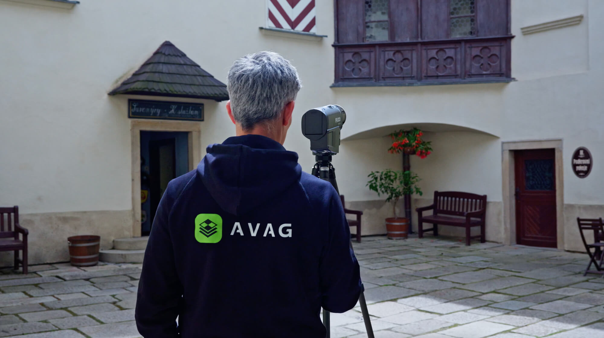
See AVAG in action
Book a quick, 15-minute discovery call to kick things off and share your goals. Then experience AVAG in a follow-up session built specifically around your unique data and workflows!
In your session, you’ll see how to:
Go from raw file to usable result in minutes, not days
Spot changes across multiple survey dates at a glance
Answer volume and terrain questions on the spot
Work with data from any source, all in one place
Get results in front of your whole team before the day is out
What teams are doing with AVAG
10.5 km of highway
10.5 km of highway
10.5 km of highway
STRABAG processed 10.5 km of highway into invoice-ready earthwork documentation in hours, with centimeter accuracy
99 users
99 users
99 users
QTS Group's 4-person drone team now supports 99 active users across 800 staff, with instant access to more than 117 datasets nationwide
Full ROI in 3 months
Full ROI in 3 months
Full ROI in 3 months
EUROVIA CZ achieved full ROI in 3 months, with real-time progress tracking and precise volume calculations
From days to minutes
From days to minutes
From days to minutes
M-SILNICE cut surveying time from days to minutes on a major highway project
Blog
Read latest news from AVAG and industry


Blog
Read latest news from AVAG and industry
Blog
Read latest news from AVAG and industry
Blog
Read latest news from AVAG and industry
Clients
What our clients say
Discover the success stories and testimonials from our satisfied clients who have transformed their workflow with AVAG.
With the AVAG application, I can easily share data with colleagues, which reduces project costs. I also appreciate that I can upload my previously processed data into the application.

Milan Hajzler
Construction manager at ŽS OHLA, a.s.
AVAG has significantly simplified our project navigation. The entire team has an overview of the overall situation on site, construction progress, and the volumes of extracted or processed materials. The ability to integrate a model of the object into the project and compare it with the current situation helps us in planning machinery deployment and determining the time requirements for different parts of the project.
Viktor Wofek
Senior Earthworks Worker at A.K.U.P.I. s.r.o.
We use the application for calculating volumes of earthworks as the primary basis for invoicing. It also serves as documentation for construction progress. Our site managers use AVAG as well, allowing them to keep track of daily work. The application saves us time and, consequently, money.
Tomáš Lauwereys
Construction manager at M - Silnice a.s.
Through the AVAG application, I can share construction data with colleagues who don’t have access to specialized programs for viewing photogrammetric data. We have a better overall view of the construction site, can easily calculate earthwork volumes, and generate terrain profiles.
Jakub Šandor
Surveyor at Eurovia CZ a.s.
We are using AVAG for sharing data allowing the end user to utilise the data to its fullest Especially, it allows us to generate profiles and volume calcs. I do love what's been made so far!
Paul Brazill
Survey Technical Manager at QTS Group
AVAG is easy to use and much simpler than having users learn GIS software. We use it for presenting data from smaller drone projects.
Søren Rolin
Senior Specialist at Niras A/S
The AVAG application allows my clients to follow projects and confirm design compliance and quantities.
George Karaolis
Quantity Surveyor at G. Roditis & Partners
With the AVAG application, I can easily share data with colleagues, which reduces project costs. I also appreciate that I can upload my previously processed data into the application.
Milan Hajzler
Construction manager at ŽS OHLA, a.s.
AVAG has significantly simplified our project navigation. The entire team has an overview of the overall situation on site, construction progress, and the volumes of extracted or processed materials. The ability to integrate a model of the object into the project and compare it with the current situation helps us in planning machinery deployment and determining the time requirements for different parts of the project.
Viktor Wofek
Senior Earthworks Worker at A.K.U.P.I. s.r.o.
We use the application for calculating volumes of earthworks as the primary basis for invoicing. It also serves as documentation for construction progress. Our site managers use AVAG as well, allowing them to keep track of daily work. The application saves us time and, consequently, money.
Tomáš Lauwereys
Construction manager at M - Silnice a.s.
Through the AVAG application, I can share construction data with colleagues who don’t have access to specialized programs for viewing photogrammetric data. We have a better overall view of the construction site, can easily calculate earthwork volumes, and generate terrain profiles.
Jakub Šandor
Surveyor at Eurovia CZ a.s.
We are using AVAG for sharing data allowing the end user to utilise the data to its fullest Especially, it allows us to generate profiles and volume calcs. I do love what's been made so far!
Paul Brazill
Survey Technical Manager at QTS Group
AVAG is easy to use and much simpler than having users learn GIS software. We use it for presenting data from smaller drone projects.
Søren Rolin
Senior Specialist at Niras A/S
The AVAG application allows my clients to follow projects and confirm design compliance and quantities.
George Karaolis
Quantity Surveyor at G. Roditis & Partners
Clients
What our clients say
Discover the success stories and testimonials from our satisfied clients who have transformed their workflow with AVAG.
With the AVAG application, I can easily share data with colleagues, which reduces project costs. I also appreciate that I can upload my previously processed data into the application.
Milan Hajzler
Construction manager at ŽS OHLA, a.s.
AVAG has significantly simplified our project navigation. The entire team has an overview of the overall situation on site, construction progress, and the volumes of extracted or processed materials. The ability to integrate a model of the object into the project and compare it with the current situation helps us in planning machinery deployment and determining the time requirements for different parts of the project.
Viktor Wofek
Senior Earthworks Worker at A.K.U.P.I. s.r.o.
We use the application for calculating volumes of earthworks as the primary basis for invoicing. It also serves as documentation for construction progress. Our site managers use AVAG as well, allowing them to keep track of daily work. The application saves us time and, consequently, money.
Tomáš Lauwereys
Construction manager at M - Silnice a.s.
Through the AVAG application, I can share construction data with colleagues who don’t have access to specialized programs for viewing photogrammetric data. We have a better overall view of the construction site, can easily calculate earthwork volumes, and generate terrain profiles.
Jakub Šandor
Surveyor at Eurovia CZ a.s.
We are using AVAG for sharing data allowing the end user to utilise the data to its fullest Especially, it allows us to generate profiles and volume calcs. I do love what's been made so far!
Paul Brazill
Survey Technical Manager at QTS Group
AVAG is easy to use and much simpler than having users learn GIS software. We use it for presenting data from smaller drone projects.
Søren Rolin
Senior Specialist at Niras A/S
The AVAG application allows my clients to follow projects and confirm design compliance and quantities.
George Karaolis
Quantity Surveyor at G. Roditis & Partners
With the AVAG application, I can easily share data with colleagues, which reduces project costs. I also appreciate that I can upload my previously processed data into the application.
Milan Hajzler
Construction manager at ŽS OHLA, a.s.
AVAG has significantly simplified our project navigation. The entire team has an overview of the overall situation on site, construction progress, and the volumes of extracted or processed materials. The ability to integrate a model of the object into the project and compare it with the current situation helps us in planning machinery deployment and determining the time requirements for different parts of the project.
Viktor Wofek
Senior Earthworks Worker at A.K.U.P.I. s.r.o.
We use the application for calculating volumes of earthworks as the primary basis for invoicing. It also serves as documentation for construction progress. Our site managers use AVAG as well, allowing them to keep track of daily work. The application saves us time and, consequently, money.
Tomáš Lauwereys
Construction manager at M - Silnice a.s.
Through the AVAG application, I can share construction data with colleagues who don’t have access to specialized programs for viewing photogrammetric data. We have a better overall view of the construction site, can easily calculate earthwork volumes, and generate terrain profiles.
Jakub Šandor
Surveyor at Eurovia CZ a.s.
We are using AVAG for sharing data allowing the end user to utilise the data to its fullest Especially, it allows us to generate profiles and volume calcs. I do love what's been made so far!
Paul Brazill
Survey Technical Manager at QTS Group
AVAG is easy to use and much simpler than having users learn GIS software. We use it for presenting data from smaller drone projects.
Søren Rolin
Senior Specialist at Niras A/S
The AVAG application allows my clients to follow projects and confirm design compliance and quantities.
George Karaolis
Quantity Surveyor at G. Roditis & Partners
Clients
What our clients say
Discover the success stories and testimonials from our satisfied clients who have transformed their workflow with AVAG.
With the AVAG application, I can easily share data with colleagues, which reduces project costs. I also appreciate that I can upload my previously processed data into the application.
Milan Hajzler
Construction manager at ŽS OHLA, a.s.
AVAG has significantly simplified our project navigation. The entire team has an overview of the overall situation on site, construction progress, and the volumes of extracted or processed materials. The ability to integrate a model of the object into the project and compare it with the current situation helps us in planning machinery deployment and determining the time requirements for different parts of the project.
Viktor Wofek
Senior Earthworks Worker at A.K.U.P.I. s.r.o.
We use the application for calculating volumes of earthworks as the primary basis for invoicing. It also serves as documentation for construction progress. Our site managers use AVAG as well, allowing them to keep track of daily work. The application saves us time and, consequently, money.
Tomáš Lauwereys
Construction manager at M - Silnice a.s.
Through the AVAG application, I can share construction data with colleagues who don’t have access to specialized programs for viewing photogrammetric data. We have a better overall view of the construction site, can easily calculate earthwork volumes, and generate terrain profiles.
Jakub Šandor
Surveyor at Eurovia CZ a.s.
We are using AVAG for sharing data allowing the end user to utilise the data to its fullest Especially, it allows us to generate profiles and volume calcs. I do love what's been made so far!
Paul Brazill
Survey Technical Manager at QTS Group
AVAG is easy to use and much simpler than having users learn GIS software. We use it for presenting data from smaller drone projects.
Søren Rolin
Senior Specialist at Niras A/S
The AVAG application allows my clients to follow projects and confirm design compliance and quantities.
George Karaolis
Quantity Surveyor at G. Roditis & Partners
With the AVAG application, I can easily share data with colleagues, which reduces project costs. I also appreciate that I can upload my previously processed data into the application.
Milan Hajzler
Construction manager at ŽS OHLA, a.s.
AVAG has significantly simplified our project navigation. The entire team has an overview of the overall situation on site, construction progress, and the volumes of extracted or processed materials. The ability to integrate a model of the object into the project and compare it with the current situation helps us in planning machinery deployment and determining the time requirements for different parts of the project.
Viktor Wofek
Senior Earthworks Worker at A.K.U.P.I. s.r.o.
We use the application for calculating volumes of earthworks as the primary basis for invoicing. It also serves as documentation for construction progress. Our site managers use AVAG as well, allowing them to keep track of daily work. The application saves us time and, consequently, money.
Tomáš Lauwereys
Construction manager at M - Silnice a.s.
Through the AVAG application, I can share construction data with colleagues who don’t have access to specialized programs for viewing photogrammetric data. We have a better overall view of the construction site, can easily calculate earthwork volumes, and generate terrain profiles.
Jakub Šandor
Surveyor at Eurovia CZ a.s.
We are using AVAG for sharing data allowing the end user to utilise the data to its fullest Especially, it allows us to generate profiles and volume calcs. I do love what's been made so far!
Paul Brazill
Survey Technical Manager at QTS Group
AVAG is easy to use and much simpler than having users learn GIS software. We use it for presenting data from smaller drone projects.
Søren Rolin
Senior Specialist at Niras A/S
The AVAG application allows my clients to follow projects and confirm design compliance and quantities.
George Karaolis
Quantity Surveyor at G. Roditis & Partners
Clients
What our clients say
Discover the success stories and testimonials from our satisfied clients who have transformed their workflow with AVAG.
With the AVAG application, I can easily share data with colleagues, which reduces project costs. I also appreciate that I can upload my previously processed data into the application.
Milan Hajzler
Construction manager at ŽS OHLA, a.s.
AVAG has significantly simplified our project navigation. The entire team has an overview of the overall situation on site, construction progress, and the volumes of extracted or processed materials. The ability to integrate a model of the object into the project and compare it with the current situation helps us in planning machinery deployment and determining the time requirements for different parts of the project.
Viktor Wofek
Senior Earthworks Worker at A.K.U.P.I. s.r.o.
We use the application for calculating volumes of earthworks as the primary basis for invoicing. It also serves as documentation for construction progress. Our site managers use AVAG as well, allowing them to keep track of daily work. The application saves us time and, consequently, money.
Tomáš Lauwereys
Construction manager at M - Silnice a.s.
Through the AVAG application, I can share construction data with colleagues who don’t have access to specialized programs for viewing photogrammetric data. We have a better overall view of the construction site, can easily calculate earthwork volumes, and generate terrain profiles.
Jakub Šandor
Surveyor at Eurovia CZ a.s.
We are using AVAG for sharing data allowing the end user to utilise the data to its fullest Especially, it allows us to generate profiles and volume calcs. I do love what's been made so far!
Paul Brazill
Survey Technical Manager at QTS Group
AVAG is easy to use and much simpler than having users learn GIS software. We use it for presenting data from smaller drone projects.
Søren Rolin
Senior Specialist at Niras A/S
The AVAG application allows my clients to follow projects and confirm design compliance and quantities.
George Karaolis
Quantity Surveyor at G. Roditis & Partners
With the AVAG application, I can easily share data with colleagues, which reduces project costs. I also appreciate that I can upload my previously processed data into the application.
Milan Hajzler
Construction manager at ŽS OHLA, a.s.
AVAG has significantly simplified our project navigation. The entire team has an overview of the overall situation on site, construction progress, and the volumes of extracted or processed materials. The ability to integrate a model of the object into the project and compare it with the current situation helps us in planning machinery deployment and determining the time requirements for different parts of the project.
Viktor Wofek
Senior Earthworks Worker at A.K.U.P.I. s.r.o.
We use the application for calculating volumes of earthworks as the primary basis for invoicing. It also serves as documentation for construction progress. Our site managers use AVAG as well, allowing them to keep track of daily work. The application saves us time and, consequently, money.
Tomáš Lauwereys
Construction manager at M - Silnice a.s.
Through the AVAG application, I can share construction data with colleagues who don’t have access to specialized programs for viewing photogrammetric data. We have a better overall view of the construction site, can easily calculate earthwork volumes, and generate terrain profiles.
Jakub Šandor
Surveyor at Eurovia CZ a.s.
We are using AVAG for sharing data allowing the end user to utilise the data to its fullest Especially, it allows us to generate profiles and volume calcs. I do love what's been made so far!
Paul Brazill
Survey Technical Manager at QTS Group
AVAG is easy to use and much simpler than having users learn GIS software. We use it for presenting data from smaller drone projects.
Søren Rolin
Senior Specialist at Niras A/S
The AVAG application allows my clients to follow projects and confirm design compliance and quantities.
George Karaolis
Quantity Surveyor at G. Roditis & Partners
See what your geospatial data can really do
Join more than 1,000 satisfied users. Just upload your files and see results.
No credit card required

See what your geospatial data can really do
Join more than 1,000 satisfied users. Just upload your files and see results.
No credit card required
See what your geospatial data can really do
Join more than 1,000 satisfied users. Just upload your files and see results.
No credit card required
See what your geospatial data can really do
Join more than 1,000 satisfied users. Just upload your files and see results.
No credit card required