What is RTK? A guide to real-time kinematic GPS
Updated:
RTK gets your drone to centimeter accuracy, so when do you still need GCPs? The answer might surprise you.
What does RTK stand for?
RTK stands for Real-Time Kinematic, a satellite positioning technique that corrects GPS/GNSS signals in real time to deliver centimeter-level location accuracy, typically within 1–3 cm, compared to the 2–5 meter accuracy of a standard GPS receiver.
The term “RTK” is most commonly used in surveying, construction, agriculture, and drone mapping. It is important to note that RTK is also an unrelated acronym in molecular biology (receptor tyrosine kinase).
What is RTK?
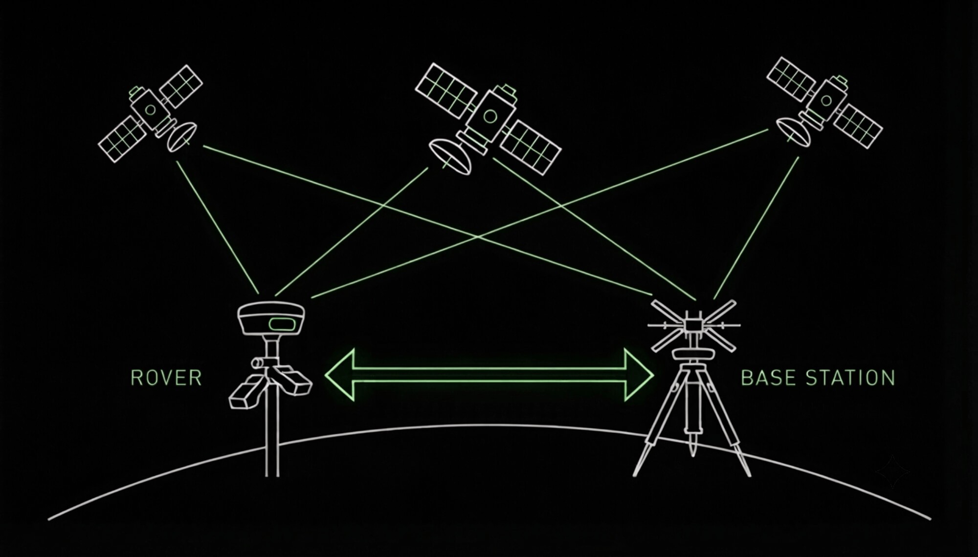
RTK is a GNSS (Global Navigation Satellite System) correction method that uses two receivers instead of one:
A base station: a stationary receiver set up at a precisely known location
A rover: the mobile receiver carried by a surveyor, mounted on machinery, or attached to a drone
The base station continuously compares its known position to the position calculated from incoming satellite signals. Any discrepancy caused by atmospheric interference, satellite clock drift, or orbital errors becomes a correction signal, which is transmitted to the rover in real time, usually over radio link or cellular network (NTRIP). The rover applies this correction to its own raw satellite data and resolves its position down to the centimeter.
This is different from standard GPS, which relies only on the timing of signals from satellites to the receiver, with no ground-based correction. That’s why consumer GPS (in a phone or car) is accurate to a few meters, while RTK GPS is accurate to a few centimeters.
What is RTK GPS?
RTK GPS refers to a GPS or GNSS receiver equipped with RTK correction capability. It’s the hardware/software combination that makes centimeter-accurate positioning possible in the field. RTK GPS systems are used for:
Land surveying: establishing precise boundary points, elevations, and control points
Construction and earthworks: machine guidance, grading, and staking out
Precision agriculture: auto-steer tractors and variable-rate application
Drone mapping and photogrammetry: geotagging photos with survey-grade accuracy so the resulting orthophotos, 3D models, and volume calculations don’t require ground control points
Infrastructure monitoring: tracking movement or deformation in structures over time
How RTK GPS accuracy compares to other positioning methods
Method | Typical accuracy | Correction source |
|---|---|---|
Standard GPS | 2–5 m | None |
DGPS (Differential GPS) | 0.5–2 m | Single correction broadcast |
RTK GPS | 1–3 cm | Real-time base station or network correction |
PPK (Post-Processed Kinematic) | 1–3 cm | Same as RTK, but corrected after data collection rather than live |
RTK vs. PPK: What’s the difference?
Since these two are frequently confused: RTK corrects positions live, in the field, while PPK (Post-Processed Kinematic) applies the same correction logic after the survey, in office software. PPK doesn’t need a live radio or cellular link between base and rover, which makes it more resilient in areas with poor connectivity, at the cost of not knowing your precise position until after processing.
RTK vs. GCPs: What’s actually enough for daily construction monitoring?
This question comes up constantly on active construction sites. You have an RTK drone, you’re flying regularly, and setting GCPs takes time. So, do you still need them?
The short answer is: yes, more often than you might think. While RTK-equipped drones allow operators to map areas quickly without deploying physical markers, Ground Control Points (GCPs) remain the gold standard for absolute accuracy, consistently outperforming RTK alone.
1. Where the correction is applied
RTK data lives inside the photo metadata (geotagging the camera center position behind the scenes). The photogrammetry software still heavily relies on internal camera calibration models and estimations to compute the rest of the 3D scene.
GCPs live directly in the physical scene. Because they are marked targets measured with survey-grade equipment, the software uses them as real-world anchors to physically warp, scale, and align the entire model. This drastically reduces compounding errors, especially in vertical accuracy and complex terrain.
2. Signal loss and systemic drift fallbacks
Signal drop safety net: If an RTK signal drops mid-flight, your data isn’t necessarily lost. It can often be recovered via PPK post-processing, but only if your drone supports it and logging was active. Without that fallback, you’re flying on standard GNSS accuracy, which is where a proper GCP network becomes the difference between a recoverable dataset and a wasted flight.
Catching Drift: GCPs catch systematic drift you won’t notice until it’s too late.
Pro-tip: Always add independent check points (minimum 3, not used in processing) to validate the result. They cost 20 minutes and can save an entire dataset.
The practical rule for construction sites
On sites moving millions of cubic meters, RTK-only is the shortcut. A well-placed GCP network, validated with independent check points, is what serious earthworks and infrastructure projects are built on. The setup cost is a few hours. The cost of a systematic error at that scale is not.
Use RTK for: Fast internal monitoring flights where you need a quick read on progress.
Use GCPs for: Situations where data drives critical decisions (volumes, billing, design comparisons, and formal hand-offs).
Why RTK matters for drone mapping and photogrammetry
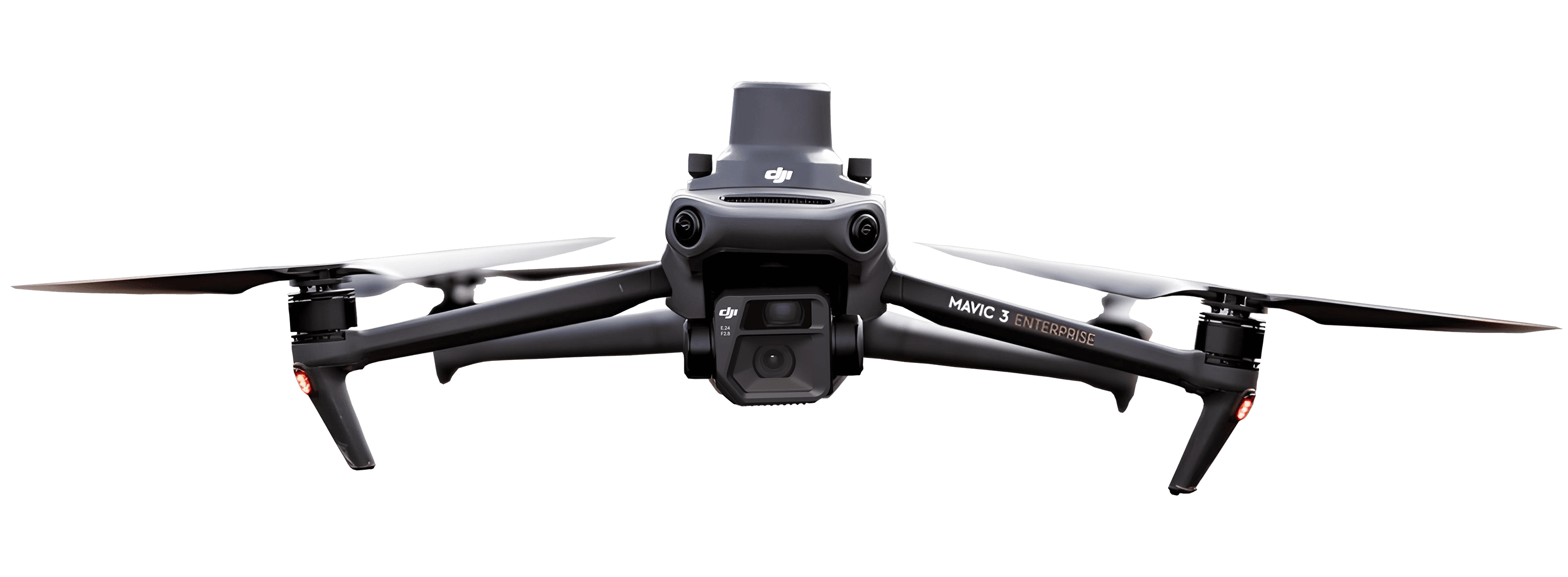
For drone-based data collection, RTK (or PPK) removes one of the biggest sources of error in photogrammetry: imprecise photo geotags. Without RTK, drone images are geotagged using the drone’s onboard GPS, which is only accurate to a few meters, meaning the resulting maps and models need ground control points (GCPs) to reach survey-grade accuracy. With RTK, each photo is tagged with centimeter-level coordinates at the moment of capture, so accurate orthophotos, 3D models, and volume calculations can be produced with little or no GCP work, saving significant time on-site.
This is especially valuable for construction sites, quarries, and linear infrastructure projects, where accurate progress monitoring and volume tracking depend on consistent, repeatable positional accuracy across multiple flights over time.
The best practice rule: Even though RTK allows you to work with little or no GCP intervention, use GCPs whenever you can. Ground Control Points remain the gold standard for absolute accuracy.
What does RTK stand for?
How accurate is RTK GPS?
Do I need a base station for RTK?
What's the difference between RTK and RTK GPS?
Is RTK the same as GPCR?
Does RTK work without internet or cellular signal?
See what your geospatial data can really do
Join more than 1,000 satisfied users. Just upload your files and see results.
No credit card required

About the author

Marek Ruzek
CTO at AVAG Pro
Marek Ruzek is the CEO and co-owner of AirView s.r.o. and the CTO behind AVAG, a cloud platform built for construction and surveying professionals working with drone data, photogrammetry, and 3D geospatial workflows. With nearly a decade leading AirView, he has been at the forefront of bringing drone-data technology to major infrastructure projects across the Czech Republic, including the D3 highway, the PPP D4 project, and large-scale earthworks monitoring.
Subscribe and do not miss latest posts
Blog
Explore more articles

What does “photogrammetrically” mean? A plain explainer
Learn what “photogrammetrically” means and how photos become accurate 3D site measurements.
Read more

How do drone service providers deliver data to clients securely?
Your drone data includes GPS coordinates, site layouts, and project timelines—do you know exactly who can access it?
Read more