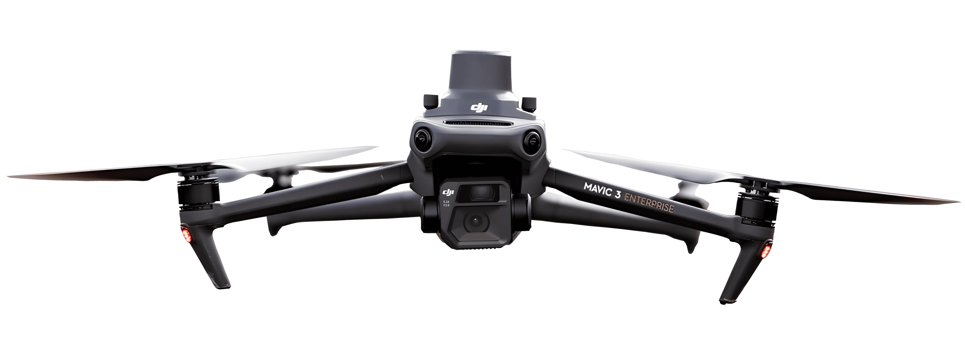
How to choose a drone in 2026: Photography, mapping, and site surveys
Updated:
Learn how to choose the right drone for your budget and goals.

Introduction
Searching for the best drones can get difficult. Every review names a different winner, and the spec sheets read like a foreign language. This guide cuts through that noise.
The honest answer is that the best drone depends on what you plan to do with it. Someone filming holiday videos needs a very different machine from a survey crew mapping a quarry.
Here is what you will learn. This article covers the buying criteria that actually matter and the best drones for each budget and job. It also explains the rules you must follow before takeoff and how your photos become measurable data.
What makes a drone the best for you
The best drone is the one that fits the job you need it to do. There is no single model that wins for everyone. Your budget and the flight rules in your area then shorten the list.
Most buyers fall into two camps. Creators want a flying camera for photos and video. Professional data collectors want accurate data they can upload to a photogrammetry platform.
That second group is growing fast. The global commercial drone market was valued at USD 24.4 billion in 2025 and is projected to reach USD 52.1 billion by 2033, at a CAGR of 9.3% (commercial drone market growth).
For professionals, the airframe is only step one. The captured data is the real point.

How to choose a drone: The criteria that matter
A few specs change the outcome more than the rest. Camera and sensor quality, weight, flight time, range, obstacle avoidance, and positioning accuracy are the ones worth studying. Below, each term is explained in plain words.
Consumer lists tend to stop at the camera. For work drones, positioning accuracy and data quality belong at the top of the list.
Camera and sensor quality
A sensor is the chip inside the camera that captures light and turns it into an image. A bigger sensor collects more light, which means sharper photos and cleaner detail in shadows.
Resolution (measured in megapixels) sets how much fine detail each frame holds. RAW capture saves the full, unprocessed image file, which gives you more to work with later.
Sharp, detailed images are not only prettier. They also produce more accurate maps and 3D models, because measurement software has cleaner detail to work from.
Weight, flight time, and range
Weight decides which rules apply to you. A sub-250g drone weighs under 250 grams, and most countries place these in the lightest regulatory category with fewer requirements.
Flight time is how long one battery lasts in the air, usually somewhere between 20 and 45 minutes. Range is how far the drone can travel from the controller while keeping a stable signal.
For a large job site, longer flight time and range mean fewer battery swaps and fewer takeoffs to cover the same ground.
Positioning accuracy: GPS vs. RTK
Standard GPS, the kind in a phone or a basic drone, can be off by several meters. That is fine for framing a photo and far too loose for a survey.
RTK, short for real-time kinematic, corrects the satellite signal live and pins each photo to within a few centimeters. Without it, crews place ground control points, or GCPs, which are marked targets on the ground with known coordinates used to correct the map. You can read RTK positioning explained for the full breakdown.
The accuracy is measurable. An RTK-equipped UAV produced a root mean square error (RMSE) of 5.58 cm in the Z direction across 71 checkpoints without ground control points, fulfilling the precision requirements for large-scale mapping (peer-reviewed accuracy study).
Best drones by use case and budget
The word "best" only makes sense once you name the use case. The table below maps each buyer type to what they should prioritize and roughly how much to budget. It endorses no single model on purpose.
One note on the market: DJI dominates current sales, so many shortlists lean on its models. Focus on the job, and let the specs pick the drone.
Buyer type | What to prioritize | Budget tier |
|---|---|---|
Beginner and hobby | Ease of use, sub-250g weight, low price | Entry-level |
Photography and travel | Camera quality, portability, stabilization | Mid-range |
Surveying, mapping, site data | RTK accuracy, sensor quality, software compatibility | Professional |
For beginners and hobby flying
New pilots should keep it simple. Prioritize a drone that is easy to fly, stays under 250 grams to dodge heavier rules, and sits at the entry-level price tier.
A light, forgiving drone lets you build skill without much risk. You can upgrade once you know what you actually need.
For photography and travel
Creators care most about the image and how easy the drone is to carry. Prioritize camera quality, a folding design that fits a small bag, and strong stabilization for smooth footage.
Longer flight time helps too, so you catch the right light without rushing back to swap a battery.
For surveying, mapping, and site data
Professional data work raises the bar. Prioritize RTK for centimeter accuracy, a high-quality sensor, and a drone whose output plugs into your processing software.
Drone type matters here. A quadcopter (four rotors) suits smaller sites and tight spaces, while a fixed-wing or VTOL drone covers large areas on a single flight. Check the list of compatible drone hardware before you buy, so the model you pick feeds your data platform without extra conversion.

My colleague Marek Ruzek with DJI Matrice 300 RTK
Where professional drones earn their keep
For many buyers, a drone is a work tool that pays for itself in saved site visits and faster reports. The industries below rely on aerial data every week.
The spending reflects that. The global construction drone market was valued at USD 3.9 billion in 2023 and is anticipated to grow at a CAGR of over 8.5% between 2024 and 2032 (construction drone market size).
Construction and earthworks
On a build, a drone flies the site in minutes and shows exactly how work is progressing. Managers use that view to check contractor work against the plan without walking every corner. Regular flights make drones on construction sites a fast way to keep office and field looking at the same picture.
Earthworks crews go a step further and measure material. Cut is soil removed, fill is soil added, and the difference between them drives payment. Accurate earthworks volume tracking turns a flight into an invoice-ready number.
Mining
Mines use drones to measure stockpile volumes and survey open pits on a schedule. A drone reads the shape of a pile far more often than a ground crew could.
It also keeps people off unstable slopes and away from active edges. Safer, repeatable mining site surveys give operators current volumes without sending someone into harm's way.
Drone service providers
Some operators fly for a living and capture data for many clients at once. They need to process each job and hand results back quickly.
The pain is usually sharing, not flying. Good drone service providers give every client secure access to their own projects, with no per-seat license bill for adding viewers.
What happens to the data after you fly
A raw drone flight is just hundreds of overlapping photos. Photogrammetry is the process where software measures the same points across those overlapping images and rebuilds the scene as a map or model.
From there you get 2D maps, detailed 3D models, and volume measurements you can actually trust. To see how the stitching works, read drone photogrammetry basics.
A cloud platform like AVAG lets the whole team open and act on those results the same day. Nobody waits a week for one specialist to export a file. Teams in more than 80 countries use AVAG, including STRABAG and Colas, to turn site flights into shared reports.
Drone rules you need to know before you fly
Flying for work comes with legal duties, and they vary by country. In the United States, commercial pilots need an FAA Part 107 certificate. In Europe, EASA sorts flights into Open, Specific, and Certified categories based on risk.
Most places also require you to register the drone. You must keep it within visual line of sight, meaning you can see it with your own eyes the whole flight. The scale of registered use is large: More than 965,000 commercial drones have been cumulatively registered under FAA Part 107 since 2016, with over 405,000 certified remote pilots as of end-2024, and the FAA projects the U.S. commercial drone fleet to surpass 1 million aircraft by 2029 (FAA commercial drone data).
Europe is busy too. We have today 1.6m+ registered drone operators in Europe, all governed by a single set of EU rules (EU drone rules).
Summary
Here is the short version to carry into your search.
Best is job-specific. Pick the drone that fits your work, not the one topping a generic list.
Match the core specs. Weigh camera, weight, flight time, and RTK against your actual use case.
Professionals go deeper. Put positioning accuracy and software compatibility near the top of the list.
Follow local rules. Certify, register, and keep the drone in sight before you fly for work.
The data is the point. For any professional job, the numbers you get after landing matter more than the airframe.
FAQ
What is the best drone to buy right now?
Which drone brand is best?
What is the best drone for surveying and mapping?
Do I need a license to fly a drone?
How much should a beginner spend on a drone?
What is an RTK drone?
See what your geospatial data can really do
Join more than 1,000 satisfied users. Just upload your files and see results.
No credit card required

About the author

Miroslav Staubr
CEO at AVAG Pro
Miroslav Staubr is the CEO and co-owner of AirView s.r.o. and the product lead behind AVAG, a cloud platform used across construction and surveying for processing drone, LiDAR, and 3D geospatial data. As a certified drone pilot with the highest permit for aerial mapping, he brings hands-on experience working with UAVs (Unmanned Aerial Vehicles), commonly known as drones, to capture precise data for photogrammetry, terrain analysis, and earthwork volume calculations.
Subscribe and do not miss latest posts
Blog
Explore more articles