Hardware
Compatible hardware
AVAG processes data from drones, mobile mapping systems, and handheld LiDAR scanners. Each works independently, or you can combine them in a single project when you need a complete picture of a site.
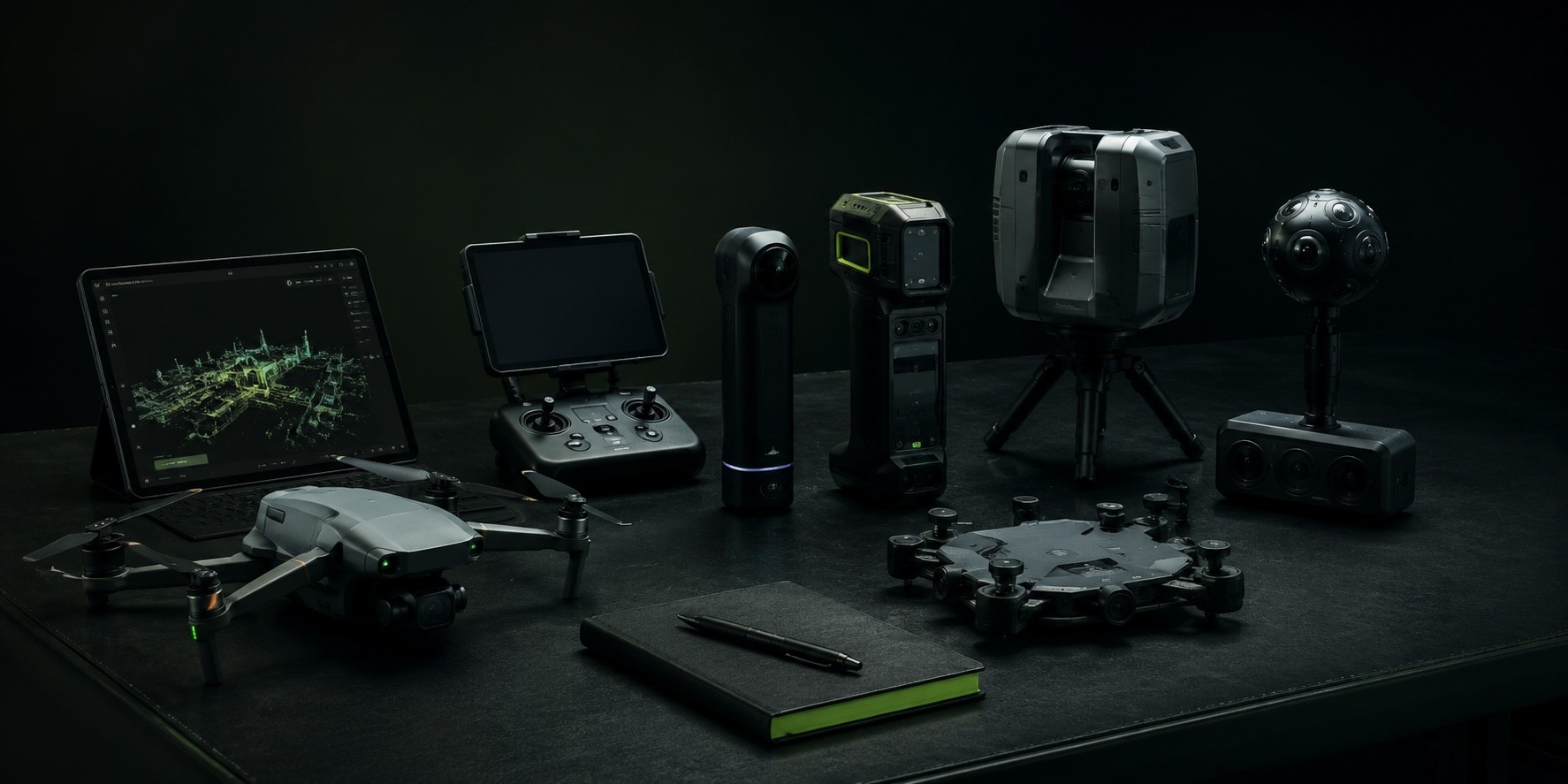
Scanner and MMS outputs like point clouds (.las), 360° panoramas (.jpg), and trajectories load directly into AVAG and can be layered alongside other geospatial data. There's no need to manually merge anything or switch between platforms.
Drones with RGB cameras
Any drone with an RGB camera. Fly your existing fleet and upload directly to AVAG for photogrammetric processing, volumetric analysis, and audit-ready reporting.


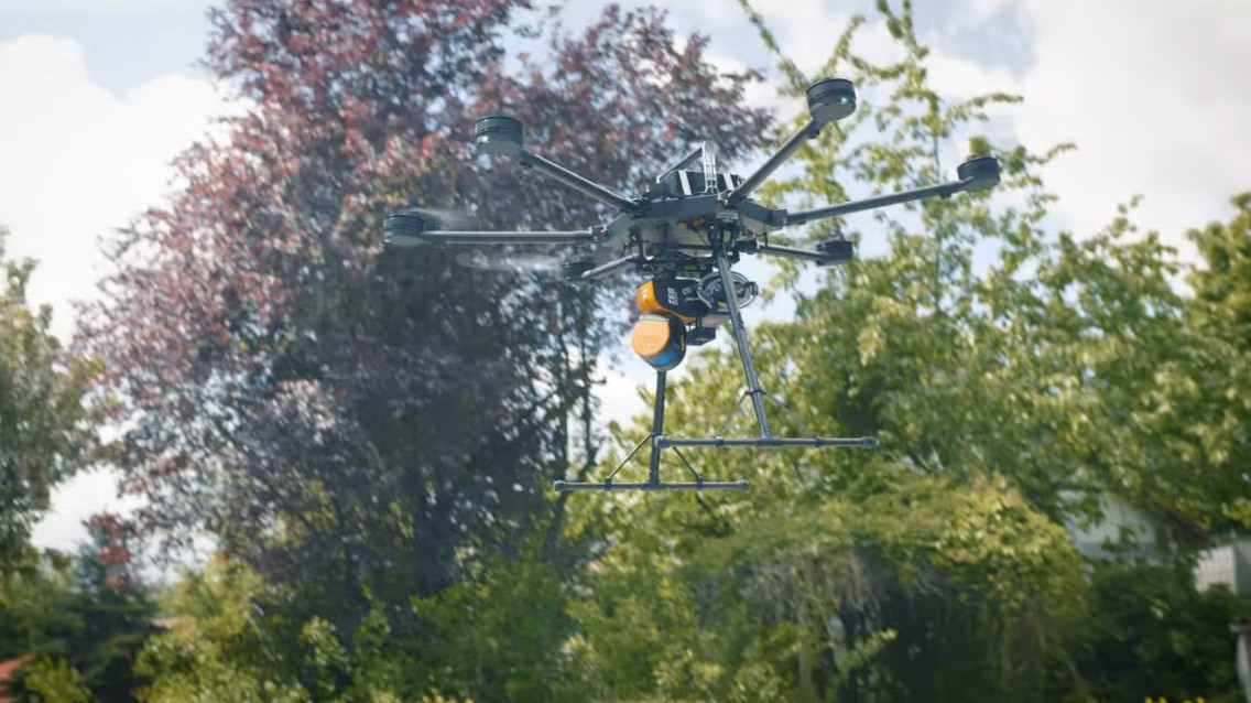
LiDAR drones
LiDAR-equipped drones deliver dense point clouds ideal for corridor mapping, vegetation penetration, and infrastructure inspection. AVAG processes the output and combines it with any other dataset in your project.
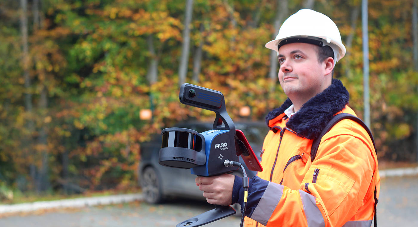
FARO Orbis / FARO Orbis Premium
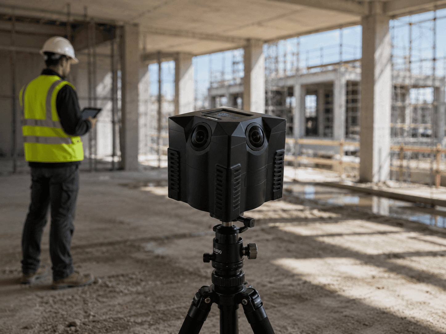
Mobile indoor mapping system for large spaces and complex interiors. Walk-through capture produces dense point clouds and 360° panoramas in a single pass, covering areas that drones can’t reach and that static scanners would take hours to document.

FARO Focus
Terrestrial laser scanner for high-precision static capture. Best suited for confined areas, structural details, and any location where precision matters more than speed.
FARO BLINK
Laser scanner for fast, flexible capture on site. Lighter and quicker to deploy than traditional terrestrial scanners, the BLINK is designed for teams that need reliable point clouds without a lengthy setup process.

GeoSLAM
Handheld LiDAR scanner for confined spaces and complex interiors. It uses SLAM (Simultaneous Localization and Mapping) to build a point cloud in real time as you walk, tracking its own position without GPS or fixed reference points,
CHC RS10
Handheld LiDAR scanner delivering survey-grade point clouds. Accurate enough for professional survey workflows, and portable enough to cover large areas on foot.

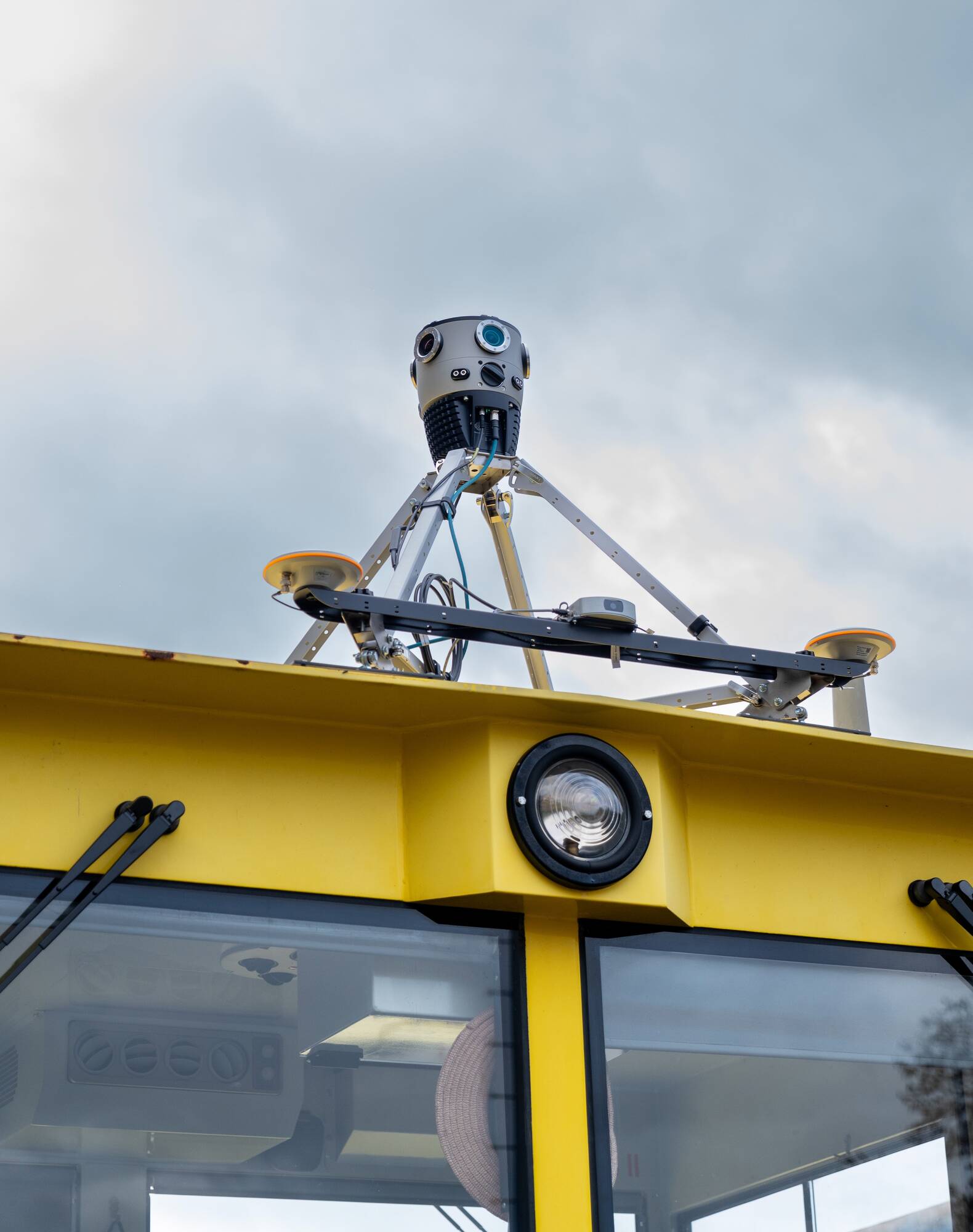
Mosaic X
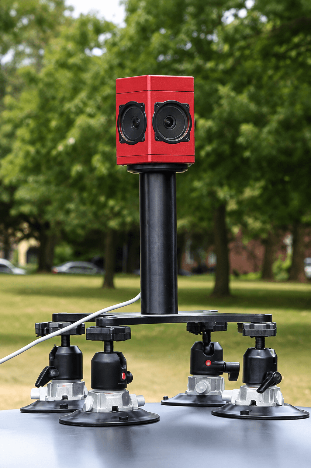
Multi-camera 360° mapping system for vehicle-mounted or backpack capture. Point clouds and panoramic imagery align with drone data captured on the same project.
iStar Pulsar
Spherical camera for high-resolution 360° documentation. Captures detailed panoramic imagery at a fixed position, useful for site walkthroughs, condition recording, and visual reference at specific locations.
FLIR Ladybug 5+
Six-lens spherical camera used in mobile mapping rigs. Typically paired with a LiDAR sensor and processed through RiPROCESS, it produces georeferenced panoramic imagery that aligns precisely with the point cloud from the same capture run.
Everything works together
Every dataset, regardless of which hardware captured it, can be layered into the same AVAG objects. Your team accesses everything from a browser, with no specialist software required.
Already have the hardware? Now get the platform.
Try AVAG free for 14 days. It works with your drones, FARO scanners, GeoSLAM, and more. No new equipment needed.

Blog
Read latest news from AVAG and industry


Blog
Read latest news from AVAG and industry
Blog
Read latest news from AVAG and industry
Blog
Read latest news from AVAG and industry
Clients
What our clients say
Discover the success stories and testimonials from our satisfied clients who have transformed their workflow with AVAG.
With the AVAG application, I can easily share data with colleagues, which reduces project costs. I also appreciate that I can upload my previously processed data into the application.

Milan Hajzler
Construction manager at ŽS OHLA, a.s.
AVAG has significantly simplified our project navigation. The entire team has an overview of the overall situation on site, construction progress, and the volumes of extracted or processed materials. The ability to integrate a model of the object into the project and compare it with the current situation helps us in planning machinery deployment and determining the time requirements for different parts of the project.
Viktor Wofek
Senior Earthworks Worker at A.K.U.P.I. s.r.o.
We use the application for calculating volumes of earthworks as the primary basis for invoicing. It also serves as documentation for construction progress. Our site managers use AVAG as well, allowing them to keep track of daily work. The application saves us time and, consequently, money.
Tomáš Lauwereys
Construction manager at M - Silnice a.s.
Through the AVAG application, I can share construction data with colleagues who don’t have access to specialized programs for viewing photogrammetric data. We have a better overall view of the construction site, can easily calculate earthwork volumes, and generate terrain profiles.
Jakub Šandor
Surveyor at Eurovia CZ a.s.
We are using AVAG for sharing data allowing the end user to utilise the data to its fullest Especially, it allows us to generate profiles and volume calcs. I do love what's been made so far!
Paul Brazill
Survey Technical Manager at QTS Group
AVAG is easy to use and much simpler than having users learn GIS software. We use it for presenting data from smaller drone projects.
Søren Rolin
Senior Specialist at Niras A/S
The AVAG application allows my clients to follow projects and confirm design compliance and quantities.
George Karaolis
Quantity Surveyor at G. Roditis & Partners
With the AVAG application, I can easily share data with colleagues, which reduces project costs. I also appreciate that I can upload my previously processed data into the application.
Milan Hajzler
Construction manager at ŽS OHLA, a.s.
AVAG has significantly simplified our project navigation. The entire team has an overview of the overall situation on site, construction progress, and the volumes of extracted or processed materials. The ability to integrate a model of the object into the project and compare it with the current situation helps us in planning machinery deployment and determining the time requirements for different parts of the project.
Viktor Wofek
Senior Earthworks Worker at A.K.U.P.I. s.r.o.
We use the application for calculating volumes of earthworks as the primary basis for invoicing. It also serves as documentation for construction progress. Our site managers use AVAG as well, allowing them to keep track of daily work. The application saves us time and, consequently, money.
Tomáš Lauwereys
Construction manager at M - Silnice a.s.
Through the AVAG application, I can share construction data with colleagues who don’t have access to specialized programs for viewing photogrammetric data. We have a better overall view of the construction site, can easily calculate earthwork volumes, and generate terrain profiles.
Jakub Šandor
Surveyor at Eurovia CZ a.s.
We are using AVAG for sharing data allowing the end user to utilise the data to its fullest Especially, it allows us to generate profiles and volume calcs. I do love what's been made so far!
Paul Brazill
Survey Technical Manager at QTS Group
AVAG is easy to use and much simpler than having users learn GIS software. We use it for presenting data from smaller drone projects.
Søren Rolin
Senior Specialist at Niras A/S
The AVAG application allows my clients to follow projects and confirm design compliance and quantities.
George Karaolis
Quantity Surveyor at G. Roditis & Partners
Clients
What our clients say
Discover the success stories and testimonials from our satisfied clients who have transformed their workflow with AVAG.
With the AVAG application, I can easily share data with colleagues, which reduces project costs. I also appreciate that I can upload my previously processed data into the application.
Milan Hajzler
Construction manager at ŽS OHLA, a.s.
AVAG has significantly simplified our project navigation. The entire team has an overview of the overall situation on site, construction progress, and the volumes of extracted or processed materials. The ability to integrate a model of the object into the project and compare it with the current situation helps us in planning machinery deployment and determining the time requirements for different parts of the project.
Viktor Wofek
Senior Earthworks Worker at A.K.U.P.I. s.r.o.
We use the application for calculating volumes of earthworks as the primary basis for invoicing. It also serves as documentation for construction progress. Our site managers use AVAG as well, allowing them to keep track of daily work. The application saves us time and, consequently, money.
Tomáš Lauwereys
Construction manager at M - Silnice a.s.
Through the AVAG application, I can share construction data with colleagues who don’t have access to specialized programs for viewing photogrammetric data. We have a better overall view of the construction site, can easily calculate earthwork volumes, and generate terrain profiles.
Jakub Šandor
Surveyor at Eurovia CZ a.s.
We are using AVAG for sharing data allowing the end user to utilise the data to its fullest Especially, it allows us to generate profiles and volume calcs. I do love what's been made so far!
Paul Brazill
Survey Technical Manager at QTS Group
AVAG is easy to use and much simpler than having users learn GIS software. We use it for presenting data from smaller drone projects.
Søren Rolin
Senior Specialist at Niras A/S
The AVAG application allows my clients to follow projects and confirm design compliance and quantities.
George Karaolis
Quantity Surveyor at G. Roditis & Partners
See what your geospatial data can really do
Join more than 1,000 satisfied users. Just upload your files and see results.
No credit card required


See what your geospatial data can really do
Join more than 1,000 satisfied users. Just upload your files and see results.
No credit card required
See what your geospatial data can really do
Join more than 1,000 satisfied users. Just upload your files and see results.
No credit card required
See what your geospatial data can really do
Join more than 1,000 satisfied users. Just upload your files and see results.
No credit card required