AVAG vs. DroneDeploy
Built for construction. Not just for drones.
DroneDeploy is a capable platform. But when your project needs accurate and fast insights, unlimited team access, and reports that regulators actually accept, the difference becomes clear.
vs.
With DroneDeploy, the features your team actually needs cost extra. With AVAG, they’re included—volume calculations, cut/fill, BIM overlays, unlimited users. Every plan. No surprises.
AVAG vs. DroneDeploy
What actually matters on a construction project
Four things AVAG does that DroneDeploy either can’t match or hides behind a custom quote.
Unlimited users. No extra cost.
Every site manager, subcontractor, and client can access live data. QTS Group runs 99 active users on a single AVAG deployment — served by just 4 drone pilots. DroneDeploy charges per seat.
Invoice-ready. Regulator-accepted.
On one of Europe’s largest highway projects, 80% of monthly earthworks invoicing was based on reports and generated in AVAG, verified and accepted by national transport regulators. No other vendor has documented regulatory acceptance for invoicing in European infrastructure.
Every layer of your project. One view.
Stack hundreds of data layers like drone surveys, BIM design files, historical captures, and terrain models in a single view or compare them side by side. The same dataset used for planning is used for verification and invoicing. No exporting, no switching tools.
All construction features. No custom quote required.
All features are included on every plan. Teams can also purchase Expert credits for processing datasets with GCPs. AVAG’s photogrammetric team then processes and verifies the results. MapClean, which removes machinery and equipment from your data, is available for teams using Expert processing.
Side by side
Feature by feature
A direct look at what each platform delivers for construction, earthworks, and infrastructure teams.
FEATURE
Volume calculations & cut/fill
AVAG
Available on all plans
DRONEDEPLOY
Requires a custom quote
Users & seats
Every user at no extra cost
Charges per user
Ground Control Points (GCPs)
Teams can purchase Expert credits to upload datasets with GCPs, and AVAG’s photogrammetric team processes the results
GCP processing locked behind a custom contract
Expert photogrammetric review
AVAG’s photogrammetric centre can review and verify outputs
No documented EU regulatory acceptance for invoicing
Processing costs
Automated processing is free. Expert processing with GCPs available to teams that purchase Expert credits (99 EUR per 500 photos)
GigaPixel limits, large projects can exhaust limits or require higher-tier contracts
Invoice-ready outputs
Reports generated in AVAG accepted by government regulators
No documented EU regulatory acceptance for invoicing
European infrastructure proof
Used across Europe’s largest infrastructure contractors like STRABAG
Strong US references, limited documented European infrastructure deployments
Honest comparison
Where DroneDeploy genuinely leads
We believe in fair comparisons. Here is where DroneDeploy has a real edge so you can make the right call for your team.
AI agents: Safety, progress & AI inspection
DroneDeploy has AI agents trained on 34 million annotations across 3 million sites. If automated AI monitoring across a portfolio is your primary need, DroneDeploy leads here.
Autonomous ground robots & docked drones
DroneDeploy has active ground robot deployments with autonomous daily capture. If continuous autonomous capture is central to your operation, this is a genuine differentiator AVAG does not currently offer.
Integrated flight planning
DroneDeploy covers planning, flying, and processing in one ecosystem. If you want a single vendor from mission to map and don't already use dedicated flight software, this is a convenience advantage.
Procore, Autodesk & Esri integrations
Proof from the field
Numbers from real projects
Every figure below is drawn from verified customer stories across European infrastructure projects.
80%
Of D35 earthworks invoiced via AVAG and accepted by government regulators
~8×
Cost saving, surveying with AVAG vs. traditional surveying (€125 vs €1,000+)
99
Active users at QTS Group, no extra cost
3 months
Time to full ROI, verified by EUROVIA on ~€4,000 investment
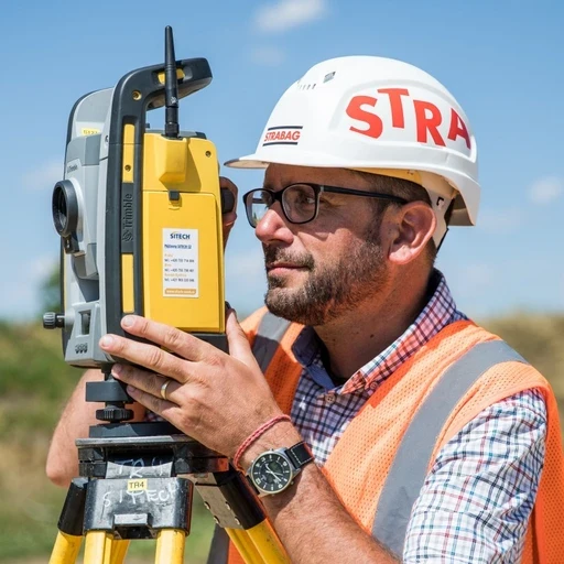
“Drones combined with AVAG are the most reliable way to measure earthwork volumes. It’s as obvious as the sun rising in the morning.”
Tomas Hladina
Head of Construction Digitalization, STRABAG
“The most valuable aspect of AVAG is that it makes drone data genuinely usable for designers, project managers and non-technical users, not just survey specialists.”

Paul Brazill
Survey Technical Manager, QTS Group
Pricing
No hidden tiers for construction features
All features included for €125/month—no custom quote, no hidden tiers. For processing with Ground Control Points (GCPs), Expert credits can be purchased. MapClean, which removes machinery and equipment from your data, is available for teams using expert processing.
€125/month
All features included on every plan
Unlimited users at no extra cost
Volume calculations & cut/fill — included
No processing caps or Gigapixel limits
Expert credits for processing with GCPs, MapClean included
14-day free trial — no credit card
$329-349/mo/seat
Cut/fill — A custom quote
Per-seat pricing
Gigapixel processing caps
No expert photogrammetric review option
AI safety and progress agents (add-on)
14-day free trial available
Getting started
Up and running in minutes, not weeks
No installation. No sales process to unlock features. No processing caps to plan around.
1.
Start your free trial
14 days, full access to all features. No credit card required. Sign up in under 60 seconds.
2.
Upload your first dataset
Drag and drop drone photos, scanner data, or processed outputs. AVAG accepts all common formats.
3.
Process and explore
Automated processing starts immediately. Orthophotos, point clouds, terrain models, and volume calculations, all in one layered view.
4.
Invite your whole team
Share with project managers, clients, subcontractors. Unlimited users, no extra licenses needed.
See the difference for yourself.
Try AVAG free for 14 days including all the features DroneDeploy puts behind a custom quote.