What does “photogrammetrically” mean? A plain explainer
Updated:
Learn what “photogrammetrically” means and how photos become accurate 3D site measurements.

You might see “photogrammetrically” in a survey report, a drone spec, or an engineering paper and wonder what it means. This guide explains the word in plain language. It then shows how photogrammetry turns ordinary photos into measurements your whole team can use.
What “photogrammetrically” means
Doing something “photogrammetrically” means measuring or building a 3D model of a real object or site from overlapping photographs. The word is the adverb form of photogrammetry, the science of taking measurements from photos. So a map made photogrammetrically is built from pictures rather than from tape measures or survey poles.
Photos alone show shape but not real size. Photogrammetry adds scale from a known reference, such as a ruler in the frame or the GPS positions of the camera. That reference tells the software how big everything really is.
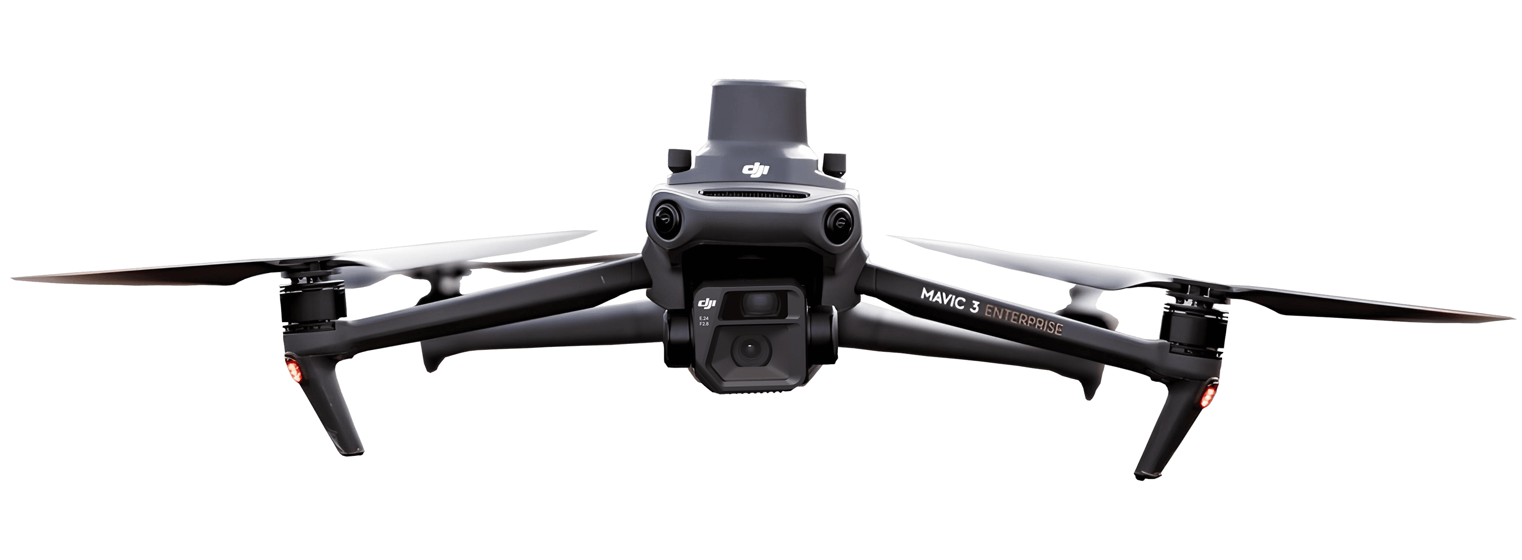
Photogrammetry once needed aircraft and expensive gear, and drones changed that. According to the FAA drone forecast, commercial drone use keeps climbing, reaching 965,524 commercial drones cumulatively registered since April 2016.
What Is photogrammetry?
Photogrammetry is the practice of making measurements from photographs. The name joins “photo” for light and “metry” for measurement.
Your eyes do something similar every second. Each eye sees a slightly different angle, and your brain combines them to judge depth and distance. Photogrammetry software works the same way with many photos taken from different spots.
When photos overlap, the software finds the same feature in several images. It then calculates where that feature sits in 3D space. Repeat this for millions of points and you get an accurate model of the whole site.
The idea is over a century old, but drones made it practical for everyday work. For a deeper walkthrough, see our guide on how drone photogrammetry works.
How photogrammetry works, step by step
Here is the workflow most drone surveys follow, from the first photo to the finished map.
First, the drone captures the images. It flies a grid pattern and takes hundreds of overlapping photos, so every point on the ground appears in several shots.
Next, software aligns the images. It matches shared features across photos, works out where the camera was for each shot, and builds a sparse point cloud, a rough scatter of 3D points.
Then it builds a dense point cloud. The software calculates a 3D position for millions of points, filling in a detailed picture of the surface.
Finally, it produces the two main outputs. One is an orthomosaic, a single photo-map with distortion removed so distances are true to scale. The other is a digital elevation model, a surface that stores the height of the ground at every point.
The modern engine behind this is structure from motion. The USGS structure-from-motion research describes it this way:
“Structure from Motion photogrammetry (SfM), a technique that uses multiple overlapping photographs to create 3D point clouds, overcomes this limitation by automatically estimating internal camera geometry, position, and orientation based on image data alone.”
The main types of photogrammetry
Photogrammetry splits into two main families, based on where the camera sits.
Aerial photogrammetry looks down from above, using drones or aircraft to map large areas. Close-range (or terrestrial) photogrammetry works up close, capturing objects and structures from the ground.
Structure from motion is the modern method that made both far cheaper, because it estimates camera positions automatically instead of needing costly pre-calibrated gear.
Type | Camera position | Typical scale | Common use |
|---|---|---|---|
Aerial photogrammetry | Above the site (drone or aircraft) | Large areas and terrain | Site mapping, earthworks, mining |
Close-range photogrammetry | Near the subject, at ground level | Single objects or structures | Building facades, heritage, inspection |
How accurate is photogrammetry?
Accuracy depends on how you capture and process the photos, not on the camera alone. Good planning gives you centimeter-level results. Careless capture gives you a pretty picture with soft numbers.
Ground control points are the biggest factor. These are marked spots on the ground with known coordinates, measured by GPS or a survey instrument, that anchor your model to the real world.
Key point: Ground control points tie your model to real coordinates, so measurements match the actual site.
Key point: Standards bodies specify accuracy in centimeters and test it with RMSE (root mean square error).
Key point: Top accuracy comes from careful control and good conditions, so it is earned on each project.
The rule of thumb comes from the standards themselves. Per ASPRS accuracy standards, “The accuracy of the ground control points should be twice the target accuracy of the final products.” So a 5 cm map needs control measured to 2.5 cm or better.
Photogrammetry vs. LiDAR
Both photogrammetry and LiDAR capture 3D measurements of a surface, but they gather the data differently. Photogrammetry extracts measurements from overlapping photos. LiDAR fires laser pulses and times how long each one takes to bounce back.
Each has strengths. Photogrammetry gives you color and texture at a lower hardware cost. LiDAR sees through gaps in vegetation better, because some laser pulses reach the ground between the leaves.
You do not have to pick one. The two can be combined in a single reference frame, so a site can use both. For a closer look, see our article on LiDAR drones.
Factor | Photogrammetry | LiDAR |
|---|---|---|
Data source | Overlapping photographs | Laser pulses |
Color and texture | Yes, true-color imagery | Points only, unless paired with a camera |
Vegetation | Struggles to see the ground under cover | Reaches the ground through gaps in foliage |
Hardware cost | Lower | Higher |
Where photogrammetry is used
Photogrammetry shows up anywhere teams need accurate measurements without walking every part of a site. Surveyors use it for mapping. Construction teams use it to track progress week to week.
Earthworks crews rely on it for cut and fill and material volumes, the numbers behind earthworks volume tracking. Mining operations use it for stockpile measurement and mining site monitoring. Heritage and environmental teams use it to document sites that change over time.
Government agencies use it too. The USGS coastal mapping workflow reports that “Structure from motion (SFM) has become an integral technique in coastal change assessment...”.
The field results back this up. Using AVAG, EUROVIA CZ captured a full site photogrammetrically in about 30 minutes with a roughly €4,000 setup that paid for itself within three months.
On the 32 km D4 highway project, Via Salis cut surveying from weeks to a single day while tracking 2,127,000 m3 of excavated material to invoicing accuracy.
The market reflects this demand. A ResearchAndMarkets construction drone market report estimates that “The global market for Construction Drones was estimated at US$4.6 Billion in 2024 and is projected to reach US$7.1 Billion by 2030, growing at a CAGR of 7.7% from 2024 to 2030.”
Turning photogrammetric data into decisions
Raw photos are only the starting point. The value is in what the software builds from them, the outputs a team can act on the same day.
A finished project usually gives you:
Volume calculations for stockpiles and earthworks, ready for invoicing.
Progress comparisons that show how the site changed between flights.
As-built documentation you can check against the design.
Shared 2D and 3D views the whole team can open, in the office or field.
Two things make this practical. AVAG lets you choose fast automated processing for straightforward sites, or expert human-reviewed processing with GCP verification for difficult ones. Every output is shareable with unlimited users, so no single specialist owns the results.
To pick the right tool, see our guide to photogrammetry software for teams. It also helps to understand what geospatial data is and how photogrammetry feeds it.
Summary
“Photogrammetrically” means measured or modeled from overlapping photographs.
The process turns overlapping photos into a 3D point cloud and accurate maps.
The two main types are aerial photogrammetry (from above) and close-range photogrammetry (up close).
Accuracy depends on capture and control, and ground control points anchor a model to real coordinates.
Photogrammetry and LiDAR both measure 3D surfaces and can be combined on one project.
For site teams, the payoff is same-day volumes and shared reports the whole team can read.
Start turning photos Into decisions
Put all your geospatial data in one place and turn photos into volume calculations, reports, and shared views. Try AVAG for free.
What does “photogrammetrically” mean?
What are the main types of photogrammetry?
Is photogrammetry the same as 3D scanning?
Is photogrammetry more accurate than LiDAR?
Is photogrammetry difficult?
What is photogrammetry used for?
See what your geospatial data can really do
Join more than 1,000 satisfied users. Just upload your files and see results.
No credit card required
About the author

Zaneta Styblova
Content Lead at AVAG Pro
Zaneta Styblova is a content professional with over eight years of experience in content marketing. She crafts impactful content that resonates with global audiences, drawing on a strong background in linguistics and a deep understanding of how language, structure, and tone shape effective communication.
Subscribe and do not miss latest posts
Blog
Explore more articles