Photogrammetry software: Complete guide to AVAG for construction, mining, and infrastructure teams
Updated:
Learn how photogrammetry software can turn your data into visualizations and insights.

Quick summary
Photogrammetry software converts geospatial data into accurate 2D maps and 3D models without expensive survey crews or specialist hardware. AVAG is a cloud-based photogrammetry platform used by 1,000+ teams across 80+ countries. It offers free automated photogrammetry processing included in every plan, plus Expert photogrammetric processing with Ground Control Points (GCPs) and human quality control at €99 per 500-photo dataset for projects where GCPs are required. With a 14-day free trial, unlimited users on every plan, and a Professional subscription at €125/month, AVAG gives construction, earthworks, mining, and other teams professional photogrammetry software without the enterprise price tag.
What is photogrammetry software, and how does it work?
Photogrammetry software takes geospatial data captured by a drone, a camera, or a mobile device and mathematically reconstructs the real world in accurate 2D and 3D form. The software identifies matching features across multiple images, calculates the 3D position of each point in space, and builds a geo-referenced model you can measure, analyze, and share.
The outputs include orthophotos (accurate 2D aerial maps), digital surface models (DSMs), digital terrain models (DTMs), textured 3D meshes, and point clouds. Modern photogrammetry platforms like AVAG go a step further, combining processing with built-in analysis tools like volume calculations, terrain profiles, cross-sections, and multi-period comparison, so teams can go from raw data to invoice-ready reports without switching applications.
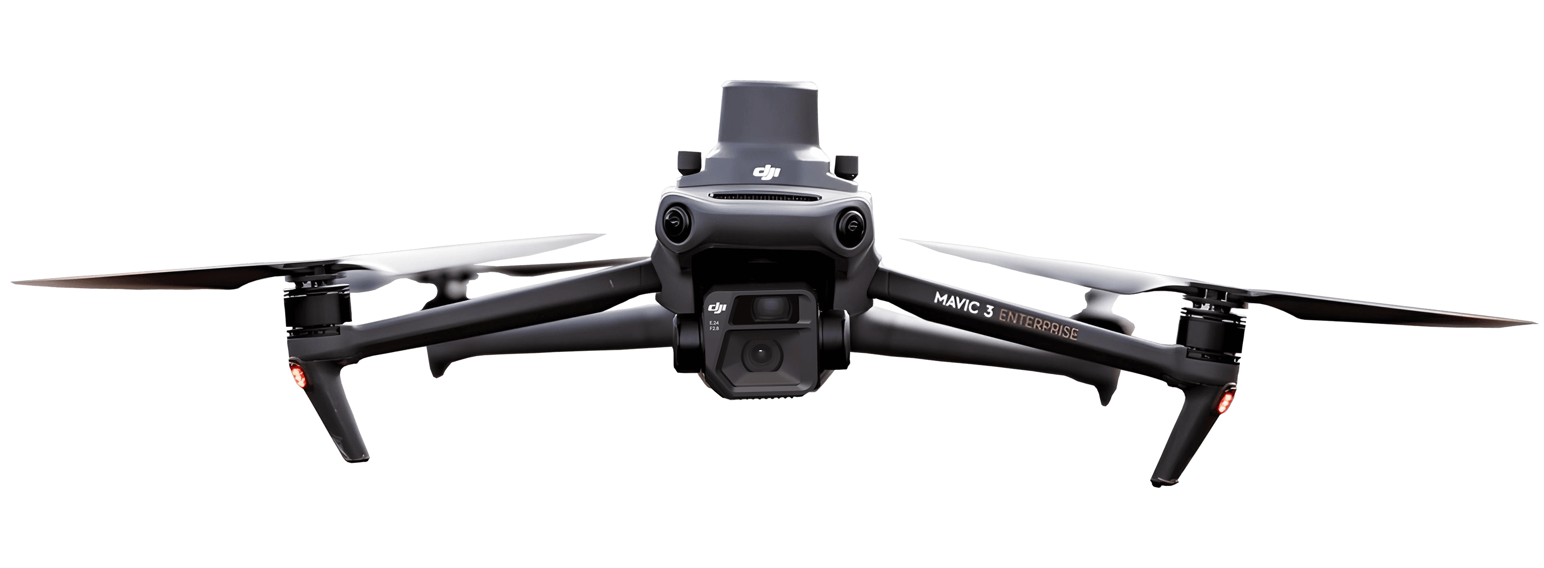
The shift from desktop photogrammetry software to cloud-based platforms has fundamentally changed who can use this technology. Processing that once required powerful local workstations, weeks of specialist time, and significant capital investment now runs in a browser on any device. AVAG processes 200 photos from a DJI Mavic 3E RTK in around 30 minutes. Expert datasets with GCPs are usually delivered in under 9 hours, with 90% of datasets uploaded before 12:00 CET processed the same day.
Free photogrammetry software: What AVAG actually offers
The search for free photogrammetry software typically leads to one of two categories: open-source desktop tools, or limited cloud trials. AVAG is a different category.
Open-source tools like Meshroom (AliceVision) and OpenDroneMap are genuinely free but require local installation, capable hardware, and technical comfort with configuration and troubleshooting. They are processing engines, not platforms, so outputs require separate tools for sharing, analysis, and reporting. For technical users with dedicated hardware, they are a legitimate option. For teams that need results their clients can open in a browser, they are the start of a much longer workflow.
AVAG’s free automated photogrammetry processing is included in every plan at no additional cost. Upload your JPGs, and AVAG’s automated pipeline returns orthophotos, DSMs, and point cloud data without any per-dataset charge. The 14-day free trial with 200 GB gives full access to this processing capability, along with all analysis and sharing tools, with no credit card required.
For projects requiring survey-grade accuracy, AVAG offers Expert photogrammetric processing at €99 per 500-photo dataset. This adds GCP verification, accuracy checks before final delivery, and semi-automated processing supervised by AVAG’s in-house photogrammetry team. It is available on any plan, and you pay per dataset, when you need it.
This structure means teams can start with free photogrammetry processing for documentation and progress monitoring, and add Expert processing only on datasets where the investment is justified by the output.
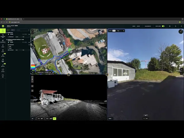
How AVAG processes drone data: From upload to shareable results
The AVAG workflow is designed to require minimal technical knowledge from the end user while returning professional outputs.
Upload: Drag and drop your photos into the AVAG browser interface. The platform accepts JPG images from standard drone flights, TIFF orthophotos and DSMs (if you’ve processed data elsewhere), and LAS/LAZ point cloud files from LiDAR sensors. It also accepts JPG 360° panoramas, high-resolution grid photos, and standard photos with GPS metadata.
Processing choice: Select Automated processing for fast turnaround at no extra cost, which is ideal for progress documentation, inspection, and any use case where relative accuracy is sufficient. Select Expert processing when GCP-controlled, human-verified accuracy is required. The processing type is chosen per dataset, not locked to your plan.
Results in the browser: Processed outputs appear in the AVAG interface, accessible to every member of your team, and every client or stakeholder you choose to share with. Every plan includes unlimited users at no extra cost.
Analysis directly on the data: Volume calculations, terrain profiles, cross-sections, multi-window comparison, and 3D measurement tools are built into the same interface. There is no export-and-reopen step between processing and analysis.
What you can do with photogrammetry data inside AVAG
AVAG is a complete platform for working with the data after it is processed, which is where most of the business value actually lives.
Volume calculation works on a single DSM layer (measuring a stockpile or excavation against ground) or between two layers (measuring cut and fill between survey dates). The MapClean function removes vehicles, equipment, and temporary structures, eliminating the most common source of measurement disputes on active sites. Results can be exported as PDF reports formatted for invoicing and audit.
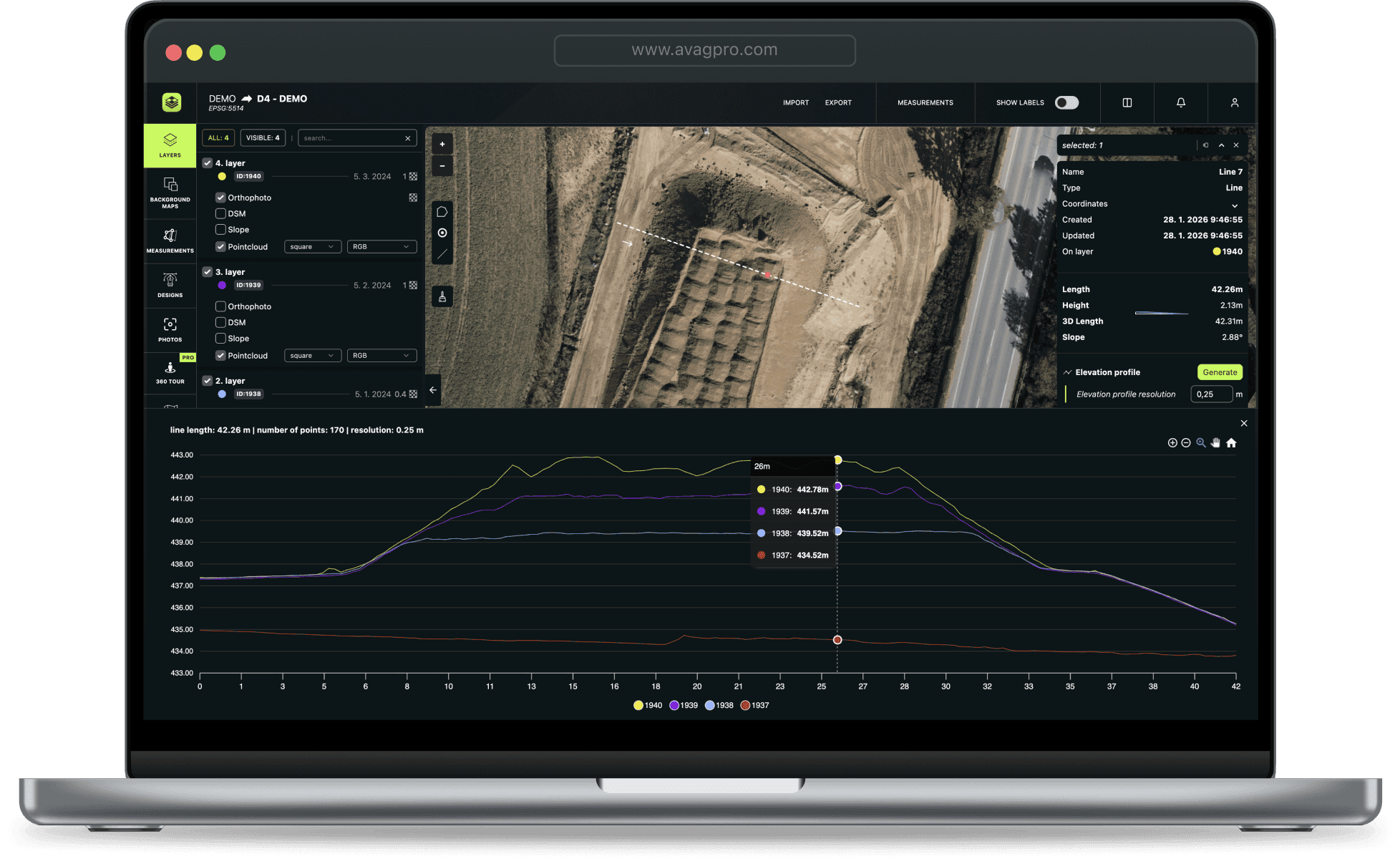
Terrain profiles and cross-sections can be generated across any layer, including imported design files. This replaces work that previously required a dedicated survey team and multiple site visits.
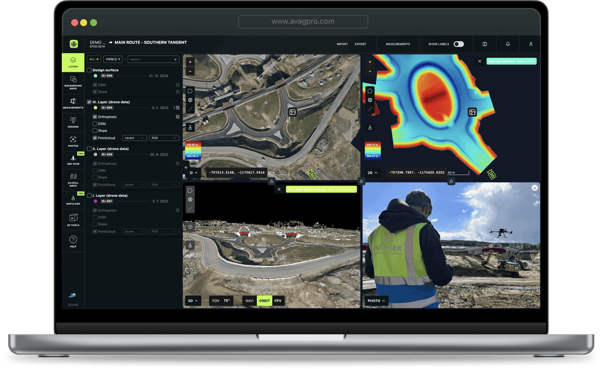
Multi-window comparison can display several survey dates or layers simultaneously on one screen, making progress trends, volume changes, and discrepancies immediately visible without toggling between files.
CAD and design overlay allows DXF files and 3D design models to be loaded over drone-captured reality. Deviations between design intent and as-built condition are visible at a glance, which is a critical quality control step on construction and infrastructure projects.
Unlimited sharing means everyone can view, measure, and annotate the same current data on any device. Unlimited users are included on every plan.
Industries using AVAG as their photogrammetry software
Photogrammetry software has moved beyond land surveying. AVAG is used wherever spatial data drives operational or financial decisions:
Construction site monitoring: Project managers and quantity surveyors use AVAG to track earthworks progress, generate volume calculations, and share site conditions with clients and subcontractors. On the D35 motorway project in the Czech Republic, 80% of monthly earthworks invoicing was processed using AVAG data, accepted directly by the Road Directorate.
Mining and quarrying: Stockpile measurement, blast verification, and pit progression tracking are handled through AVAG’s polygon-based volume tools. AVAG is trusted by major industry players including STRABAG, Vinci Construction, and Colas.
Infrastructure inspection: Bridge, road, tower, and rail corridor documentation uses photogrammetry to create layered visual records that support change detection and long-term condition monitoring.
Earthworks: AVAG’s two-layer volume calculation and terrain profile tools are specifically built for earthworks quantification, tracking cut and fill between design and reality or between two survey periods.
Drone service providers: Survey companies use AVAG to process, analyze, and deliver photogrammetry outputs to their clients as a finished product (maps, volumes, models, and reports) within a single platform.
Agriculture: Crop damage documentation uses photogrammetry to produce geolocated evidence for insurance claims, replacing manual assessment with precise, repeatable spatial data.
Real-world photogrammetry results: AVAG on major infrastructure projects
D4 Motorway, 32 km PPP project. A 17 km corridor survey that previously took several weeks was surveyed in a single day using drone photogrammetry and AVAG. Data was available in the platform within 24 hours of each flight. Total volume tracked: 2,127,000 m³.
D35 Motorway, STRABAG. 80% of monthly earthworks invoicing was processed using AVAG photogrammetry data, with outputs accepted by the Road Directorate.
Railway corridor, EUROVIA CZ. A survey requiring several workers over several days was completed by a single pilot in 30 minutes. Full return on investment within three months.
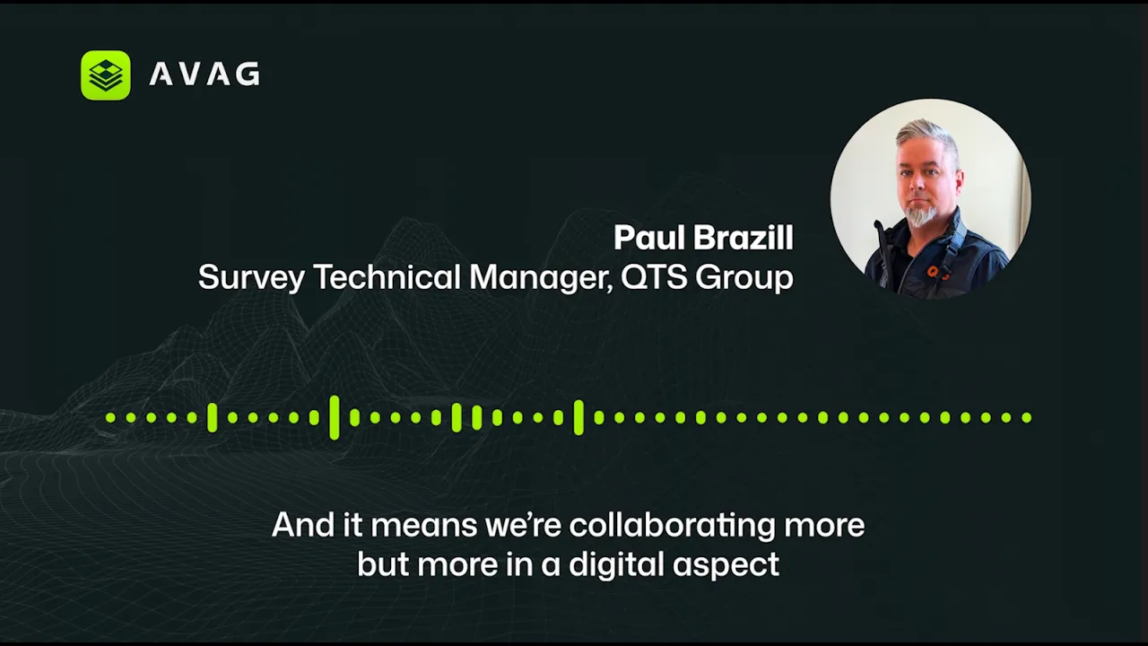
UK rail network, QTS Group. A 4-person drone team now supports 99 active users across 800 staff nationwide, spanning survey, design, and project management using instant access to 117 datasets. Teams access live 2D/3D data directly in AVAG without needing specialist involvement or custom deliverables.
Comparing AVAG to other photogrammetry software options
Agisoft Metashape is powerful desktop photogrammetry software widely used by surveyors and researchers. It requires a capable local workstation, produces high-quality outputs, and offers significant processing customization. It is not a cloud platform, there are no built-in sharing, analysis, or reporting tools. AVAG delivers comparable photogrammetric accuracy in a cloud environment with built-in analysis and unlimited sharing, at a fraction of the cost for most professional use cases.
Pix4D (Pix4Dmapper, Pix4Dmatic) is the benchmark photogrammetry platform for many surveying professionals. Technically deep and well-regarded for accuracy, it is also demanding to operate and expensive at scale. AVAG’s cloud-first model removes the local hardware requirement and the per-seat licence structure.
DroneDeploy is a broad cloud platform with strong construction and agriculture features. A close workflow competitor to AVAG. AVAG differentiates through its Expert processing option with human photogrammetric QC, deeper presence on European infrastructure projects, and its unlimited-user pricing model.
Propeller Aero is strong in earthworks and construction. It does not support viewing multiple datasets simultaneously. AVAG’s multi-window view handles up to four at once. For teams doing comparative time-series analysis, this is a significant practical limitation.
Meshroom (open-source, free). For technical users with suitable local hardware, Meshroom is a legitimate free photogrammetry option. It has no cloud access, no analysis tools, and no sharing capability. It is a processing engine, not a platform. AVAG’s free automated processing tier covers the same photogrammetric output, adds analysis and sharing, and requires no local hardware.
Pricing: AVAG photogrammetry software plans
AVAG’s pricing is structured around three plans, with processing options available independently of which plan they’re on.
Trial — Free, 14 days. Full platform access including automated photogrammetry processing, volume calculation, multi-window comparison, terrain profiles, and unlimited sharing. Processed outputs cannot be downloaded during the trial. No credit card required.
Professional — €125/month. Everything in the trial, plus downloadable outputs (TIFF, LAS, and others), team collaboration features, and 200 GB storage with the option to add more. Unlimited users included. Annual billing available with a discount.
Enterprise — Custom. Everything in Professional, plus custom storage capacity, custom integrations, on-premise deployment options, and advanced features.
Processing add-on — Expert photogrammetric processing, €99 per 500-photo dataset. Available on any plan, GCP verification, accuracy checks before delivery, and semi-automated processing by AVAG's photogrammetric team. Average delivery under 9 hours; 90% of datasets uploaded before 12:00 CET are processed the same day.
Extra storage — €25/month per 100 GB additional, charged proportionally from your subscription date.
Getting started with free photogrammetry processing
The fastest way to evaluate AVAG is to start the 14-day free trial, upload a recent dataset from your own projects (or explore our demo data), and run automated photogrammetry processing. Most projects return results within 30 minutes to a few hours depending on your dataset size.
AVAG is available in six languages—Czech, English, German, Polish, Portuguese, and Spanish—and works with any drone hardware and selected scanners, mobile mapping systems (MMS), and 360° cameras.
Start your free trial at avagpro.com. No credit card required.
See what your geospatial data can really do
Join more than 1,000 satisfied users. Just upload your files and see results.
No credit card required

About the author
Miroslav Staubr
CEO at AVAG Pro
Miroslav Staubr is the CEO and co-owner of AirView s.r.o. and the product lead behind AVAG, a cloud platform used across construction and surveying for processing drone, LiDAR, and 3D geospatial data. As a certified drone pilot with the highest permit for aerial mapping, he brings hands-on experience working with UAVs (Unmanned Aerial Vehicles), commonly known as drones, to capture precise data for photogrammetry, terrain analysis, and earthwork volume calculations.
Subscribe and do not miss latest posts
Blog
Explore more articles

The complete guide to choosing photogrammetry software (2026)
If you’re currrently choosing your next photogrammetry platform, this guide is for you.
Read more

Ground Sample Distance: What GSD really means for your site projects
Flying a 50-megapixel drone but still getting blurry maps? Here’s what you’re missing.
Read more